Table of Contents
What Is Volcanology?
Volcanology (also spelled vulcanology) is the branch of geology that studies volcanoes, volcanic eruptions, magma, lava, and related geological phenomena. Volcanologists investigate how magma forms deep in the Earth, how it rises to the surface, why eruptions vary from gentle lava flows to catastrophic explosions, and how to monitor volcanic activity to protect communities.
About 800 million people worldwide live within 100 kilometers of an active volcano, making this field literally a matter of life and death.
How Volcanoes Form
A volcano is fundamentally a vent in Earth’s crust through which molten rock (magma), gases, and ash reach the surface. But understanding why magma exists and why it rises requires knowing a bit about what’s happening beneath your feet.
Earth’s interior is layered. The thin outer crust (5-70 km thick) sits on the mantle — a roughly 2,900 km thick layer of rock that’s mostly solid but behaves like a very viscous fluid over geological timescales. The mantle isn’t uniformly hot or uniformly composed, and those variations create the conditions for magma generation.
Here’s the crucial point: the mantle is mostly NOT molten. It’s solid rock under enormous pressure. Magma forms only under specific conditions that lower the melting point of rock or raise the temperature above it. Three main scenarios create these conditions:
Divergent Boundaries
Where tectonic plates pull apart — like the Mid-Atlantic Ridge — the mantle rises to fill the gap. As it rises, the pressure decreases, and the rock’s melting point drops. The mantle partially melts (only 5-15% becomes liquid), producing basaltic magma that erupts along the rift. This process creates new ocean floor and is responsible for the longest mountain chain on Earth — entirely underwater. Iceland sits directly on the Mid-Atlantic Ridge, which is why it has so many volcanoes.
Convergent Boundaries (Subduction Zones)
Where one tectonic plate dives beneath another — the Pacific Ring of Fire is the classic example — the descending plate carries water-saturated oceanic crust into the mantle. Water dramatically lowers the melting point of rock, causing the overlying mantle wedge to partially melt. This produces magma that’s more silica-rich (and therefore more viscous and explosive) than mid-ocean ridge basalt.
The Ring of Fire — a horseshoe-shaped band circling the Pacific Ocean — hosts about 75% of the world’s volcanoes and is responsible for about 90% of the world’s earthquakes. Mount Fuji, Mount St. Helens, Krakatoa, and the Andes volcanoes are all subduction zone volcanoes.
Hot Spots
Some volcanoes form far from plate boundaries, over persistent columns of hot mantle material called “mantle plumes.” Hawaii is the textbook example — the Pacific Plate slowly moves northwest over a fixed hot spot, creating a chain of volcanic islands. The Big Island (with its active Kilauea and Mauna Loa volcanoes) sits directly over the hot spot today. The older islands to the northwest — Maui, Oahu, Kauai — were each above the hot spot in the past.
Yellowstone is another hot spot, this one beneath continental crust. The Yellowstone hot spot has produced a track of volcanic calderas stretching across Idaho and Wyoming over the past 16 million years.
Types of Volcanoes
Not all volcanoes look like the classic cone-shaped mountain. Volcanic landforms vary widely depending on the type of magma and style of eruption.
Shield volcanoes are broad, gently sloping structures built by fluid basaltic lava flows. They’re shaped like a warrior’s shield laid on the ground — hence the name. Mauna Loa in Hawaii is the world’s largest active shield volcano, rising about 4,170 meters above sea level (and another 5,000 meters from the ocean floor — making it taller than Everest if measured from base to summit). Shield volcano eruptions are typically effusive — lava flows outward rather than exploding upward.
Stratovolcanoes (composite volcanoes) are the classic cone-shaped volcanoes — Mount Fuji, Mount Rainier, Mount Vesuvius. They’re built from alternating layers of lava flows, volcanic ash, and pyroclastic debris. Their steeper profiles reflect the more viscous magma that doesn’t flow far before solidifying. Stratovolcanoes produce the most dangerous eruptions because their viscous magma traps gas, building enormous pressure that releases explosively.
Cinder cones are small, steep-sided cones built from fragments of solidified lava (cinders, bombs, blocks) ejected from a single vent. They rarely exceed 300 meters in height and often form on the flanks of larger volcanoes. Paricutin in Mexico — which famously erupted from a farmer’s cornfield in 1943 and grew to 424 meters in nine years — is a cinder cone.
Calderas form when a volcano’s magma chamber empties during a massive eruption and the overlying rock collapses into the void. Yellowstone’s caldera is 72 km long by 45 km wide. Crater Lake in Oregon fills a caldera that formed about 7,700 years ago when Mount Mazama erupted and collapsed. Calderas are associated with the largest and most catastrophic eruptions in Earth’s history.
Lava domes are mounds of viscous lava that pile up around a vent rather than flowing away. They grow by internal inflation and can collapse catastrophically, generating pyroclastic flows. The lava dome in Mount St. Helens’ crater has been growing since 2004.
Eruption Mechanics: Why Some Eruptions Explode
The single most important factor determining eruption style is magma viscosity, which is primarily controlled by silica content.
Low-silica magmas (basalt, ~50% SiO₂) are fluid. Gas bubbles can escape easily, so pressure doesn’t build up. Eruptions tend to be effusive — lava flows out gently, sometimes forming spectacular fountains and rivers of molten rock but rarely producing violent explosions. Hawaiian eruptions are the classic example.
High-silica magmas (rhyolite, ~70% SiO₂; andesite, ~60% SiO₂) are viscous. Gas bubbles get trapped, pressure builds, and when the confining rock finally fails, the result is explosive fragmentation — magma shatters into ash, pumice, and larger fragments that blast upward in eruption columns that can reach 40+ km into the stratosphere.
The dissolved gas content matters too. Magma typically contains 1-6% dissolved water, plus carbon dioxide, sulfur dioxide, and other gases. As magma rises toward the surface, decreasing pressure allows gas to come out of solution (like uncapping a carbonated drink). In fluid magma, gas escapes gradually. In viscous magma, gas stays trapped until catastrophic release.
Temperature also affects viscosity — hotter magma flows more easily. Basaltic magma erupts at 1,100-1,250°C, while rhyolitic magma erupts at 650-800°C. The combination of lower temperature and higher silica makes rhyolitic magma hundreds to thousands of times more viscous than basalt.
Volcanic Hazards
Volcanic eruptions produce several distinct hazards, each dangerous in different ways.
Pyroclastic flows are the deadliest. These are superheated avalanches of gas, ash, and rock fragments that race down volcano flanks at 100-700 km/h at temperatures of 200-700°C. You cannot outrun them. You cannot survive being caught in one. The destruction of Pompeii in 79 AD was caused by pyroclastic flows from Mount Vesuvius. The 1902 eruption of Mount Pelee in Martinique killed 28,000 people in minutes when a pyroclastic flow swept through the city of Saint-Pierre.
Lahars (volcanic mudflows) are mixtures of volcanic debris and water that flow down river valleys like concrete. They can travel over 100 km from the volcano and devastate communities that consider themselves far from volcanic danger. The 1985 eruption of Nevado del Ruiz in Colombia melted glacial ice, producing lahars that buried the town of Armero, killing 23,000 people. The tragedy was amplified because scientists had warned of the risk weeks earlier, but evacuation orders were delayed.
Ash fall covers wide areas with fine volcanic glass particles. Heavy ash fall can collapse roofs, contaminate water supplies, destroy crops, ground aircraft (volcanic ash destroys jet engines), and cause respiratory problems. The 2010 Eyjafjallajokull eruption in Iceland produced an ash cloud that shut down European airspace for six days, stranding millions of passengers.
Lava flows destroy everything in their path but usually move slowly enough for people to evacuate. Exceptions exist — some basaltic lava flows can move at 30 km/h on steep slopes. The most common damage from lava flows is property destruction rather than loss of life.
Volcanic gases — primarily water vapor, CO₂, SO₂, H₂S, and HCl — can be lethal. CO₂ is heavier than air and can accumulate in low-lying areas. In 1986, Lake Nyos in Cameroon (a volcanic crater lake) released a massive burst of dissolved CO₂ that flowed downhill, suffocating 1,746 people and thousands of livestock.
Tsunamis can be triggered by volcanic eruptions, submarine explosions, or caldera collapse. The 2022 eruption of Hunga Tonga-Hunga Ha’apai generated a tsunami that struck Tonga’s coastline within minutes.
Monitoring Volcanoes
Modern volcanology relies heavily on monitoring technology to forecast eruptions and protect communities. The goal isn’t prediction (naming the exact time and size of an eruption) but forecasting (estimating probability and potential scenarios).
Seismic Monitoring
Magma moving through rock produces seismic signals. Networks of seismometers around volcanoes detect these signals — increased earthquake frequency, tremor (continuous vibration caused by fluid movement), and specific waveforms associated with magma migration. A swarm of small earthquakes beneath a volcano is one of the most reliable eruption precursors.
The 1980 Mount St. Helens eruption was preceded by two months of increasing seismicity, which allowed volcanologists to warn the public and establish exclusion zones. The 57 people who died were mostly outside the exclusion zones or had refused to evacuate.
Ground Deformation
When magma accumulates beneath a volcano, the surface swells. This deformation can be measured using GPS stations, InSAR (satellite radar interferometry), and tiltmeters. Before the 2018 Kilauea eruption in Hawaii, GPS stations detected centimeters of ground inflation — indicating magma was accumulating in the summit reservoir.
InSAR is particularly powerful because it covers large areas from space. Satellites compare radar images taken at different times, mapping surface deformation with millimeter precision across entire volcanic regions.
Gas Emissions
Changes in the composition and volume of volcanic gases indicate changes in the magma system. Increased SO₂ emissions suggest fresh, gas-rich magma is rising. CO₂ increases can indicate deeper magma movement. Gas monitoring uses ground-based spectrometers, drone-mounted sensors, and satellite measurements.
Thermal Monitoring
Satellite-based thermal sensors detect heat anomalies at volcanic craters — new fumaroles, hot springs, or warming crater lakes that indicate increased activity. Thermal cameras provide continuous monitoring of dome growth and lava flow activity.
Integration
No single monitoring technique is sufficient. Modern volcano observatories — like the USGS Cascades Volcano Observatory, the Hawaiian Volcano Observatory, and Japan’s volcano monitoring network — integrate seismic, deformation, gas, thermal, and visual data into multi-parameter systems. Machine learning is increasingly used to identify patterns across these datasets that human analysts might miss.
Measuring Eruptions: The VEI Scale
When you hear an eruption described as “VEI 6,” that’s the Volcanic Explosivity Index — a logarithmic scale (much like the Richter scale for earthquakes) that ranks eruptions from 0 to 8 based mainly on how much material they eject.
Each step up the scale represents roughly a tenfold increase in erupted volume. A VEI 1 eruption (think gentle Hawaiian fountaining) puts out less than 10,000 cubic meters. A VEI 4 — the 2010 Eyjafjallajokull eruption that grounded European flights — ejects more than 0.1 cubic kilometers. A VEI 8, the “supervolcano” category, ejects over 1,000 cubic kilometers. Only a handful of VEI 8 events are known in the geological record, and none has occurred in recorded human history.
The scale has a quirk worth understanding: it measures explosive volume, not danger to people. A small VEI 2 eruption next to a crowded city can kill far more people than a remote VEI 6. The deadliest eruptions in history weren’t always the biggest — they were the ones that happened near unprepared populations. That distinction shapes how volcanologists rank risk versus raw size.
The scale also struggles at its extremes. Purely effusive eruptions — vast outpourings of fluid lava like the flood basalts that formed the Deccan Traps in India — barely register on the VEI because they’re not explosive, yet they erupted volumes that dwarf any Plinian event and may have contributed to mass extinctions. So volcanologists rarely lean on VEI alone. They pair it with eruption duration, magma type, the height of the eruption column, and how far hazardous deposits traveled, building a fuller picture than any single number can give.
A Short History of the Field
People have watched volcanoes erupt for as long as they’ve lived near them, but volcanology as a science is fairly young. The Romans had no mechanism to explain Vesuvius — Pliny the Younger’s careful written account of the 79 AD eruption is treasured precisely because such observation was rare.
For centuries, eruptions were explained through mythology or assumed to be burning underground coal and sulfur. The shift toward real science came in the 1700s and 1800s. Sir William Hamilton, the British envoy to Naples, made detailed observations of Vesuvius in the late 1700s and is sometimes called one of the first true volcanologists. In 1841, the world’s first volcano observatory was established on the flank of Vesuvius.
The field’s biggest leap came with plate tectonics in the 1960s. Before that, nobody could explain why volcanoes cluster where they do. Once geologists accepted that Earth’s surface is broken into moving plates, the global distribution of volcanoes suddenly made sense — and volcanology connected to the broader story of geophysics and seismology. The 1980 Mount St. Helens eruption, watched and measured by scientists in real time, then turned volcano monitoring from theory into a working discipline.
Reading the Rocks: Petrology and Geochemistry
A lot of volcanology happens nowhere near an erupting crater. It happens in labs, looking at rocks and crystals under microscopes.
When magma cools, it forms crystals in a predictable order, and those crystals trap tiny pockets of the original melt — called melt inclusions — like time capsules. By analyzing them, a volcanologist working in geochemistry can reconstruct how deep the magma sat, how hot it was, how much gas it held, and how fast it rose. This is partly how scientists estimate the depth of magma chambers they can’t see.
Crystals also act as clocks. Certain elements diffuse through a crystal at known rates, so the chemical gradients inside a single crystal can reveal that magma was disturbed days, weeks, or years before an eruption — sometimes matching the timing of earthquake swarms detected at the surface. This kind of “crystal forensics” has reshaped how scientists think about what actually triggers an eruption. Often it’s not the slow buildup of pressure but a fresh injection of hotter magma from below that destabilizes the system.
Famous Eruptions in History
Vesuvius (79 AD) — buried Pompeii and Herculaneum under pyroclastic deposits, preserving them as remarkable archaeological sites. Pliny the Younger’s written account of the eruption gave “Plinian” eruptions their name.
Tambora (1815) — the largest eruption in recorded history (VEI 7). Ejected roughly 160 km³ of material. The following year, 1816, was known as the “Year Without a Summer” — global temperatures dropped 0.4-0.7°C, causing crop failures and famine across the Northern Hemisphere.
Krakatoa (1883) — produced one of the loudest sounds in recorded history, heard nearly 5,000 km away. The eruption and subsequent tsunami killed over 36,000 people. The atmospheric effects produced vivid red sunsets worldwide for months.
Mount St. Helens (1980) — the lateral blast (a sideways explosion triggered by a massive landslide) devastated 600 km² of forest. 57 people died. The eruption was extensively documented and studied, making it one of the most important eruptions for advancing volcanological understanding.
Pinatubo (1991) — one of the largest eruptions of the 20th century (VEI 6). Successful forecasting and evacuation saved thousands of lives, though the lahars and ash fall still caused enormous destruction. The eruption injected enough SO₂ into the stratosphere to cool global temperatures by about 0.5°C for two years.
Volcanoes and Climate
Volcanic eruptions affect climate through two main mechanisms.
Stratospheric aerosols. Large eruptions inject sulfur dioxide into the stratosphere (above ~15 km altitude), where it converts to sulfuric acid aerosol droplets. These aerosols reflect incoming sunlight, cooling the planet. The effect is temporary — the aerosols settle out within 1-3 years — but significant. Pinatubo’s cooling effect was measurable by satellite.
Long-term carbon cycling. Over geological timescales, volcanic CO₂ emissions are a major input to Earth’s carbon cycle. Without volcanic outgassing, atmospheric CO₂ would eventually be drawn down by weathering and biological processes. Volcanoes maintain the greenhouse effect that keeps Earth habitable. However, current human CO₂ emissions are roughly 100 times greater than all volcanic CO₂ emissions combined — so volcanoes aren’t causing modern climate change.
Volcanology as a Career
Volcanology is a specialization within earth science and geophysics. Most volcanologists hold a PhD in geology, geophysics, geochemistry, or a related field. The educational path typically includes a bachelor’s in geology or physics, followed by graduate research focused on volcanic processes.
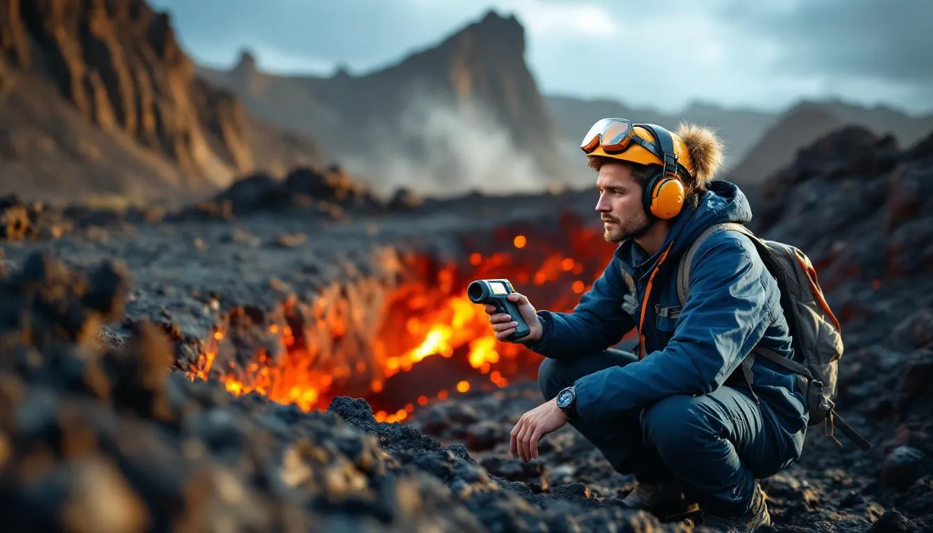
The work combines fieldwork (often in remote and sometimes dangerous locations), laboratory analysis (petrology, geochemistry, isotope analysis), and computational modeling. Field volcanologists collect samples from active craters, deploy monitoring instruments, and map volcanic deposits. Some of the field conditions are genuinely extreme — working near active lava flows, climbing active volcanoes, or sampling gases from fumaroles at temperatures exceeding 600°C.
Employment opportunities exist at universities, government geological surveys (USGS, British Geological Survey, GNS Science New Zealand), volcano observatories, and increasingly in the insurance and risk assessment industries.
The field has a notable mortality rate. Since 1979, over 30 volcanologists have been killed by volcanic eruptions while conducting fieldwork — including the husband-and-wife team Maurice and Katia Krafft, killed by a pyroclastic flow at Mount Unzen in Japan in 1991. The risks are real, and volcanologists are acutely aware that the phenomena they study can kill them.
Despite — or perhaps because of — the danger, volcanology attracts passionate scientists who are driven by equal parts scientific curiosity and desire to protect vulnerable communities. Every eruption forecast that enables a successful evacuation validates the entire discipline. And with hundreds of millions of people living in volcanic hazard zones, the work has never been more important.
Frequently Asked Questions
How many active volcanoes are there on Earth?
There are roughly 1,350 potentially active volcanoes on land, plus an unknown number on the ocean floor. About 40-50 volcanoes are erupting at any given time. The Smithsonian's Global Volcanism Program tracks all known volcanic activity worldwide.
Can we predict when a volcano will erupt?
We can often forecast eruptions days to weeks in advance using seismic monitoring, gas emissions, ground deformation, and thermal imaging. However, precise prediction — naming the exact time and magnitude — remains impossible. Some volcanoes erupt with little warning.
What is the most dangerous type of volcanic eruption?
Plinian eruptions — massive explosive events that produce towering ash columns and pyroclastic flows — are the most dangerous. Pyroclastic flows (superheated gas and rock mixtures traveling at 100-700 km/h at temperatures up to 700C) are the deadliest volcanic hazard, responsible for more fatalities than any other eruption product.
Could a supervolcano eruption end civilization?
A Yellowstone-scale supereruption would be catastrophic regionally and cause global climate cooling for years. But it wouldn't end human civilization — we'd face severe agricultural disruption, ash fall over a wide area, and economic damage, but humanity has survived past supereruptions (Toba, ~74,000 years ago).
Why do people live near active volcanoes?
Volcanic soils are extremely fertile, supporting productive agriculture. Geothermal energy provides cheap power. Many volcanic areas are culturally significant, and some eruptions happen so infrequently that the risk feels abstract. About 800 million people live within 100 km of an active volcano.
Further Reading
Cite this article
APA
WhatIs.site. (2025). What Is Volcanology?. Retrieved May 27, 2026, from https://whatis.site/volcanology MLA
"What Is Volcanology?." WhatIs.site, July 15, 2025, https://whatis.site/volcanology. Accessed May 27, 2026. Chicago
WhatIs.site. "What Is Volcanology?." Last modified May 12, 2026. https://whatis.site/volcanology. HTML
<a href="https://whatis.site/volcanology">What Is Volcanology?</a> — WhatIs.site Related Articles
What Is Geology?
Geology is the scientific study of Earth — its structure, composition, the physical and chemical processes that shape it.
scienceWhat Is Earth Science?
Earth science is the broad field of study concerned with the physical makeup and processes of planet Earth—its rocks, water, atmosphere.
scienceWhat Is Seismology?
Seismology is the study of earthquakes and seismic waves. Learn how seismographs work, what causes quakes, magnitude scales, and how we predict seismic hazards.
scienceWhat Is Geophysics?
Geophysics is the branch of science that applies the principles and methods of physics to study Earth's structure, composition.
scienceWhat Is Geochemistry?
Geochemistry is the scientific discipline that uses chemistry principles to study the composition, structure.