
Table of Contents
What Is Seismology?
Seismology is the scientific study of earthquakes and the propagation of elastic waves through the Earth. It encompasses the measurement of ground motion, the analysis of earthquake sources and mechanisms, the mapping of Earth’s internal structure using seismic waves, and the assessment of seismic hazard for engineering and public safety. In practical terms, seismologists are trying to understand why the ground shakes, what happens inside the Earth when it does, and how to reduce the damage when the next big one hits.
The Earth experiences roughly 500,000 detectable earthquakes per year. About 100,000 are strong enough for people to feel, and roughly 100 cause damage. Every few years, a major earthquake kills thousands and causes billions in damage—the 2011 Tohoku earthquake and tsunami killed nearly 20,000 people in Japan and caused $235 billion in damage, making it the costliest natural disaster in history.
What Causes Earthquakes
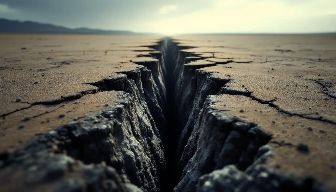
Most earthquakes are caused by the sudden release of energy that has accumulated along geological faults—fractures in the Earth’s crust where blocks of rock slide past each other. The energy source is plate tectonics: the slow but relentless movement of Earth’s lithospheric plates, driven by convection currents in the underlying mantle.
Plate Tectonics: The Engine
Earth’s outer shell is divided into about 15 major tectonic plates and numerous smaller ones, each moving at speeds of 1-15 centimeters per year. That sounds slow—and it is, roughly the speed your fingernails grow—but these plates weigh trillions of tonnes and carry entire continents. The forces involved are staggering.
Where plates interact, three types of boundaries create most of the world’s earthquakes:
Convergent boundaries (plates colliding) produce the largest and most destructive earthquakes. When an oceanic plate dives beneath a continental plate (subduction), the contact zone can lock and accumulate strain over centuries, then release it in a catastrophic megathrust earthquake. The 2011 Tohoku earthquake (M9.1), the 2004 Indian Ocean earthquake (M9.1), and the 1960 Chile earthquake (M9.5—the largest ever recorded) were all subduction zone events.
Transform boundaries (plates sliding past each other) produce moderate to large earthquakes. The San Andreas Fault in California is the most famous example—the Pacific Plate slides northwest past the North American Plate at about 46 mm per year. The resulting earthquakes include the devastating 1906 San Francisco earthquake (estimated M7.9).
Divergent boundaries (plates pulling apart) produce smaller, shallower earthquakes. Mid-ocean ridges—where new crust forms as plates separate—generate frequent but mostly moderate seismicity. Iceland, sitting astride the Mid-Atlantic Ridge, experiences this regularly.
Elastic Rebound Theory
The mechanism by which faults generate earthquakes was explained by Harry Fielding Reid after studying the 1906 San Francisco earthquake. His elastic rebound theory is elegantly simple:
- Tectonic forces gradually deform the rock on either side of a fault, storing elastic strain energy (like bending a stick).
- Friction on the fault prevents the two sides from sliding.
- When the accumulated stress exceeds the fault’s frictional strength, the fault ruptures suddenly.
- The deformed rock snaps back to its undeformed shape (elastic rebound), releasing the stored energy as seismic waves.
The energy release happens in seconds—centuries of accumulated strain released in a moment. A large earthquake fault might slip 5-20 meters in less than a minute. The classical mechanics of elastic deformation and wave propagation govern the entire process.
Non-Tectonic Earthquakes
Not all earthquakes come from tectonic plate interactions:
Volcanic earthquakes are caused by magma movement, gas pressure, and volcanic edifice collapse. They’re typically small but can signal impending eruptions.
Induced seismicity results from human activities: reservoir-induced seismicity (water weight from dam filling stresses underlying faults), hydraulic fracturing (fracking), geothermal energy extraction, mining, and wastewater injection. Oklahoma, which historically experienced fewer than 2 magnitude-3+ earthquakes per year, had over 900 in 2015—almost all linked to wastewater injection from oil and gas operations. This has become a significant public concern and regulatory challenge.
Collapse earthquakes occur when underground voids (caves, mines) collapse. They’re small, localized, and usually shallow.
Seismic Waves: How Earthquakes Travel
When a fault ruptures, it generates waves that radiate outward through the Earth—much like ripples from a stone dropped in a pond, but in three dimensions and through solid rock rather than water.
Body Waves
P-waves (Primary waves) are compressional waves—they push and pull material in the direction of travel, like sound waves in air. They’re the fastest seismic waves (5-8 km/s in the crust, up to 13.7 km/s in the core) and arrive first at seismograph stations. P-waves travel through solids, liquids, and gases.
S-waves (Secondary waves) are shear waves—they displace material perpendicular to the direction of travel, like a wave on a rope. They’re slower than P-waves (3-5 km/s in the crust) and arrive second. Critically, S-waves cannot travel through liquids because liquids don’t resist shear. This property is what revealed that Earth’s outer core is liquid—S-waves from distant earthquakes disappear in the S-wave shadow zone on the opposite side of Earth from the earthquake, blocked by the liquid core.
Surface Waves
Love waves are horizontally polarized shear waves confined to the surface. They move the ground side-to-side—devastating for buildings because structures handle vertical loads well but lateral loads poorly.
Rayleigh waves produce a rolling, elliptical ground motion—like ocean waves but in solid rock. They’re the slowest seismic waves and often the most destructive because of their large amplitude and long duration.
Surface waves do the most damage during earthquakes. They travel more slowly than body waves but carry more energy near the surface, where people and buildings exist. During the 1985 Mexico City earthquake, surface waves amplified by soft lake sediments beneath the city produced ground accelerations that destroyed over 400 buildings.
Measuring Earthquakes
Seismographs
A seismograph measures ground motion by recording the relative movement between a frame (attached to the ground) and a suspended mass (which stays approximately still due to inertia). In modern instruments, this relative movement generates an electrical signal that’s digitized and recorded.
Modern broadband seismometers can detect ground movements as small as a nanometer (a billionth of a meter)—roughly the diameter of a hydrogen atom. They can record everything from nearby traffic vibrations to the surface waves of an earthquake on the opposite side of the planet. The Global Seismographic Network operates about 150 stations worldwide, providing continuous monitoring of global seismicity.
Acoustics principles underlie seismograph design—both disciplines deal with detecting and analyzing wave propagation through a medium, though seismology’s medium is rock rather than air.
Magnitude Scales
Richter magnitude (ML) was developed in 1935 by Charles Richter for local earthquakes in California. It’s a logarithmic scale: each whole number increase represents a 10-fold increase in ground displacement and about 31.6 times more energy release. An M5 earthquake releases roughly 31.6 times more energy than an M4, and about 1,000 times more than an M3.
Richter magnitude has limitations: it saturates (doesn’t distinguish well between very large earthquakes) and only works for local earthquakes at specific distances and frequencies.
Moment magnitude (Mw) replaced Richter magnitude for most scientific purposes. It’s based on the seismic moment—a physical measure of the earthquake source that accounts for the fault area, the average displacement, and the rigidity of the rock. Moment magnitude doesn’t saturate and is directly related to the physics of the earthquake source. When you hear earthquake magnitudes reported today, they’re almost always moment magnitude, even though news outlets still say “Richter scale” by habit.
Modified Mercalli Intensity (MMI) measures earthquake effects at specific locations on a scale from I (not felt) to XII (total destruction). Unlike magnitude (which is a single number per earthquake), intensity varies geographically. An M7.0 earthquake might produce MMI IX (heavy damage) near the epicenter and MMI III (felt indoors) at 200 km distance.
Earthquake Location
Seismologists determine earthquake locations using the difference in arrival times of P-waves and S-waves at multiple stations. Because P-waves travel faster than S-waves, the time gap between their arrivals increases with distance from the source. With arrival times from three or more stations, the earthquake’s epicenter (surface location) and hypocenter (subsurface location, also called the focus) can be triangulated.
Modern location algorithms use data from hundreds of stations simultaneously, producing locations accurate to within a few kilometers for well-monitored regions. Data analysis techniques including Bayesian statistical methods are used to quantify location uncertainty.
Looking Inside the Earth
Here’s something remarkable about seismology: most of what we know about Earth’s interior comes from studying earthquake waves. We can’t drill deeper than about 12 km (the Kola Superdeep Borehole in Russia), but seismic waves from large earthquakes penetrate to the center of the planet—6,371 km down—and the way they travel reveals the internal structure.
The Layered Earth
Seismic wave speeds change at boundaries between materials of different composition or physical state. These velocity changes cause waves to reflect and refract, much like light at a glass surface. By analyzing the arrival times, amplitudes, and waveforms of seismic phases recorded worldwide, seismologists have mapped Earth’s internal structure in remarkable detail:
Crust (0-5 km under oceans, 0-70 km under continents): Low velocity, variable composition. The Mohorovicic discontinuity (Moho) at the base of the crust is marked by a sharp increase in P-wave velocity from about 6.5 to 8.0 km/s.
Mantle (Moho to 2,900 km): Higher velocity, solid but slowly flowing on geological timescales. The mantle isn’t uniform—seismic velocities reveal a low-velocity zone at 100-250 km depth (the asthenosphere, where partial melting reduces wave speeds), and discontinuities at 410 and 660 km depth marking mineral phase transitions.
Outer core (2,900-5,150 km): Liquid iron alloy. S-waves don’t pass through it. P-wave velocity drops sharply at the core-mantle boundary. The liquid outer core generates Earth’s magnetic field through convection-driven dynamo action.
Inner core (5,150-6,371 km): Solid iron-nickel alloy. Discovered by Inge Lehmann in 1936 through careful analysis of P-wave reflections. Recent research suggests the inner core may have distinct layers and may even rotate at a slightly different rate than the rest of the planet.
Seismic Tomography
Just as a medical CT scan images the body’s interior by sending X-rays through it from multiple angles, seismic tomography images Earth’s interior by analyzing seismic waves from thousands of earthquakes recorded at thousands of stations. Regions where waves travel faster than average are inferred to be cooler and denser (such as subducting slabs). Regions where waves travel slower are inferred to be warmer and less dense (such as mantle plumes beneath hotspots like Hawaii and Yellowstone).
Seismic tomography has revealed structures that plate tectonics theory predicted but couldn’t directly observe: slabs of subducted ocean floor sinking through the mantle, some all the way to the core-mantle boundary. It’s also revealed unexpected features, including massive low-velocity provinces at the base of the mantle beneath Africa and the Pacific—continent-sized blobs of anomalous material whose origin and composition remain debated.
Seismic Hazard and Engineering
Seismology’s most direct impact on society is through earthquake hazard assessment and seismic engineering.
Seismic Hazard Maps
Probabilistic seismic hazard analysis (PSHA) estimates the likelihood of different levels of ground shaking at a given location over a specified time period. The USGS National Seismic Hazard Model, for example, estimates that parts of the San Francisco Bay Area have roughly a 72% probability of experiencing an M6.7+ earthquake by 2043.
These hazard assessments drive building codes. Areas with high seismic hazard require structures designed to withstand stronger shaking—more strong foundations, flexible steel frames, reinforced concrete, and base isolation systems. Civil engineering practice in seismically active regions is fundamentally shaped by seismological hazard analysis.
Site Effects
The same earthquake can cause dramatically different shaking at two locations the same distance from the epicenter—all because of local geology. Soft sediments (clay, sand, fill) amplify seismic waves compared to bedrock. This site amplification can increase ground acceleration by factors of 2-10.
The 1989 Loma Prieta earthquake demonstrated this vividly in San Francisco: areas built on bedrock experienced moderate shaking, while the Marina District—built on fill dumped after the 1906 earthquake—experienced intense shaking, liquefaction (soil behaving like liquid), and building collapse. Same earthquake, same city, vastly different outcomes based on what was underneath the buildings.
Liquefaction
When saturated, loose sand is subjected to earthquake shaking, it can temporarily lose its load-bearing capacity and behave like a liquid. Buildings sink, tilt, and collapse. Underground pipes and tanks float to the surface. Liquefaction caused extensive damage in the 2011 Christchurch earthquake (New Zealand), the 2011 Tohoku earthquake (Japan), and countless other events.
Identifying liquefaction-susceptible soils and designing foundations to resist liquefaction are active areas of geotechnical engineering. Solutions include deep foundations extending to bedrock, soil densification (vibrating or compacting the soil to reduce susceptibility), and drainage systems that dissipate excess pore water pressure.
Tsunami Generation
Submarine earthquakes that displace the seafloor vertically can generate tsunamis—long-wavelength ocean waves that cross entire ocean basins and inundate coastlines. The 2004 Indian Ocean tsunami, generated by an M9.1 earthquake, killed approximately 230,000 people across 14 countries.
Tsunami warning systems use seismographic networks to detect tsunamigenic earthquakes and deep-ocean pressure sensors (DART buoys) to confirm tsunami generation. Warning times range from minutes (for nearby coasts) to hours (for distant coasts). The effectiveness of these systems was demonstrated in 2011—Japan had about 30 minutes of warning before the tsunami arrived, and many people who received and heeded the warning survived.
Earthquake Prediction vs. Forecasting
The distinction matters enormously. Prediction means specifying the time, location, and magnitude of a future earthquake with enough precision to take protective action (evacuate, shut down infrastructure). Despite enormous effort, no reliable short-term prediction method exists. Various proposed precursors—foreshock patterns, radon gas emissions, groundwater changes, animal behavior, electromagnetic anomalies—have been studied extensively. None has proven reliable enough for operational prediction.
Forecasting means estimating the probability of an earthquake of a given magnitude in a given region over a given time period. This is routine and scientifically sound. We know that the Cascadia Subduction Zone off the Pacific Northwest will produce a M9+ earthquake—the geological record shows these occur every 200-600 years, and the last one was in 1700. We can’t say when the next one will happen, but we can say the probability over the next 50 years is estimated at roughly 10-15%.
This probabilistic approach, while unsatisfying to people who want to know “when,” is genuinely useful. It drives building codes, emergency planning, infrastructure investment, and public awareness. Climatology uses similar probabilistic approaches to forecast extreme weather events and long-term climate trends.
Early Warning Systems
Although prediction remains elusive, early warning is now operational in several countries. Earthquake early warning (EEW) systems detect the initial P-waves from an earthquake (which travel faster but cause less damage) and issue alerts before the destructive S-waves and surface waves arrive.
Japan’s system provides 5-30 seconds of warning depending on distance from the epicenter. That doesn’t sound like much, but it’s enough to stop trains, halt surgeries, open fire station doors, and alert people to drop, cover, and hold on. The ShakeAlert system on the U.S. West Coast became operational in 2021 and has successfully issued warnings for several moderate earthquakes.
Modern Frontiers
Slow Slip Events and Tremor
In the past two decades, seismologists discovered that faults don’t just lock and slip violently—some sections slip slowly and silently over days to months, releasing energy equivalent to magnitude 6-7 earthquakes but without any ground shaking you’d feel. These “slow slip events” are accompanied by a characteristic seismic signal called tectonic tremor—a continuous, low-amplitude vibration distinct from regular earthquakes.
Slow slip events are being studied intensively because they may load stress onto adjacent locked fault sections, potentially triggering future earthquakes. Understanding the relationship between slow slip and eventual fast rupture is one of the most active research frontiers in seismology.
Induced Seismicity Management
As human activities increasingly trigger earthquakes—through wastewater injection, geothermal energy, mining, and reservoir impoundment—managing induced seismicity has become urgent. “Traffic light” protocols are now standard in many jurisdictions: seismic monitoring triggers operational changes (reduced injection rates, well shutdowns) if induced earthquakes exceed specified thresholds.
The science of induced seismicity is advancing rapidly, with improved models of how fluid pressure changes activate faults and better statistical methods for distinguishing induced from natural seismicity.
Ambient Noise Seismology
Traditional seismology relies on earthquakes as seismic sources. But researchers discovered that continuous background noise—from ocean waves, wind, human activity—contains useful seismic information. By cross-correlating noise recorded at pairs of stations, seismologists can extract information about the Earth structure between them without waiting for an earthquake. This technique has revolutionized the imaging of shallow crustal structure and enables time-lapse monitoring of velocity changes related to volcanic activity, fluid injection, and other processes.
Distributed Acoustic Sensing (DAS)
Fiber optic cables—the same ones carrying your internet data—can function as dense arrays of seismic sensors. By sending laser pulses down a fiber and analyzing the backscattered light, every meter of cable becomes a seismometer. A single 10 km fiber optic cable becomes 10,000 sensors. DAS is being deployed on ocean-bottom cables, in boreholes, and along existing telecommunication routes, creating seismic monitoring density that was previously inconceivable.
Why Seismology Matters
Earthquakes are the deadliest natural hazard over recorded history. An estimated 13 million people have died in earthquakes in the past 4,000 years. The 1556 Shaanxi earthquake in China killed approximately 830,000 people—still the deadliest earthquake in recorded history.
Modern seismology can’t prevent earthquakes, but it can dramatically reduce their impact. Seismic hazard assessment informs where and how to build. Building codes save lives—the contrast between earthquake impacts in countries with enforced modern codes (Japan, Chile, New Zealand) versus those without (Haiti, Nepal, Iran) is stark and heartbreaking.
Seismology has also given us something no other science provides: a detailed picture of our planet’s interior, all the way to the center, derived entirely from waves that travel through it. We know more about the structure 6,000 km beneath our feet than we do about the ocean floor 6 km below sea level. That’s the remarkable power of reading the signals that earthquakes send through the body of the Earth.
How the Field Got Started
Seismology is younger than you might guess. People have recorded earthquakes for millennia—Chinese scholar Zhang Heng built a famous bronze seismoscope around 132 CE that dropped a ball from a dragon’s mouth toward the direction of distant shaking—but the science of measuring ground motion quantitatively only took off in the late 1800s. British geologist John Milne, working in Japan after the 1880 Yokohama earthquake, developed the first practical seismographs and is often called the father of modern seismology. By the early 20th century, instrument networks were dense enough that researchers like Andrija Mohorovicic (1909) and Inge Lehmann (1936) could deduce the boundaries inside the Earth purely from how waves bent and bounced. The whole picture of a layered planet was assembled in roughly four decades, without anyone ever drilling more than a few kilometers down.
Beyond Earthquakes: Other Uses of Seismic Waves
A lot of seismology has nothing to do with natural earthquakes at all. Exploration seismology uses controlled sources—small explosions, or “thumper” trucks that vibrate the ground—to image rock layers a few kilometers deep. The oil, gas, and mineral industries rely on this; so do engineers checking the ground beneath a planned dam or tunnel. Forensic seismology analyzes signals from explosions, and the CTBTO — the international body enforcing the nuclear-test-ban treaty — runs a global monitoring network that can detect and locate underground nuclear tests anywhere on Earth, distinguishing them from natural quakes by their distinctive waveforms. Seismometers have even recorded glaciers calving, meteor impacts, and the rumble of large crowds at sporting events.
Working as a Seismologist
If the subject grabs you, it’s a real career path. Most research seismologists hold a graduate degree in geophysics or earth science and work for government agencies (the USGS, national geological surveys), universities, or the energy sector. The day-to-day blends fieldwork—installing and maintaining stations—with heavy data analysis: writing code to process waveforms, building velocity models, and running simulations. Strong programming and statistics skills now matter as much as classic geology, since modern networks generate terabytes of continuous data. Engineering seismologists work alongside civil engineering teams to translate hazard estimates into building codes and retrofit designs. It’s a field where curiosity about the planet meets very practical stakes: the work directly shapes how safely millions of people live on shaking ground.
Frequently Asked Questions
Can we predict earthquakes?
Not yet—not in the precise sense of specifying the date, location, and magnitude of a future earthquake. Despite decades of research, no reliable short-term prediction method exists. What seismologists CAN do is forecast seismic hazard: identifying regions with high probability of significant earthquakes over decades, based on fault mapping, historical seismicity, and geodetic strain measurements. This probabilistic approach informs building codes and emergency planning even though it can't predict specific events.
What's the difference between magnitude and intensity?
Magnitude measures the energy released by an earthquake at its source—it's a single number for each earthquake (e.g., M7.0). Intensity measures the effects at a specific location—how strongly the ground shook, how much damage occurred. The same earthquake produces different intensities at different locations: stronger near the epicenter, weaker farther away. Magnitude is measured by instruments; intensity is assessed from observed effects using the Modified Mercalli Intensity scale (I-XII).
What causes aftershocks?
Aftershocks occur because the stress changes caused by a mainshock leave the surrounding crust in a new, unstable stress state. Areas near the fault that were brought closer to failure by the mainshock's stress redistribution slip in subsequent smaller earthquakes. Aftershock sequences follow predictable statistical patterns (described by Omori's law and Bath's law): they decrease in frequency over time, and the largest aftershock is typically about one magnitude unit smaller than the mainshock.
Has the biggest possible earthquake already happened?
The largest recorded earthquake was the 1960 Valdivia earthquake in Chile at M9.5. The theoretical maximum magnitude depends on the length of fault that ruptures simultaneously. The longest subduction zones (around 4,000-5,000 km) could theoretically produce earthquakes slightly larger than M9.5, perhaps up to about M10. But such events would be extremely rare—recurrence intervals of thousands to tens of thousands of years. An M10 would release about 30 times more energy than the 1960 Chilean event.
Why do some earthquakes cause more damage than others of the same magnitude?
Damage depends on many factors beyond magnitude: depth (shallow earthquakes cause more surface damage), distance from populated areas, local soil conditions (soft sediments amplify shaking—a phenomenon called site amplification), building quality, duration of shaking, and frequency content of the seismic waves. A M6.5 in a densely populated area on soft soil with poor construction can be catastrophic, while a M7.5 in a remote area on bedrock may cause no casualties.
Further Reading
Cite this article
APA
WhatIs.site. (2026). What Is Seismology?. Retrieved May 27, 2026, from https://whatis.site/seismology MLA
"What Is Seismology?." WhatIs.site, March 6, 2026, https://whatis.site/seismology. Accessed May 27, 2026. Chicago
WhatIs.site. "What Is Seismology?." Last modified May 12, 2026. https://whatis.site/seismology. HTML
<a href="https://whatis.site/seismology">What Is Seismology?</a> — WhatIs.site Related Articles
What Is Civil Engineering?
Civil engineering designs and builds infrastructure like roads, bridges, and buildings. Learn about its branches, history, and how it shapes daily life.
scienceWhat Is Classical Mechanics?
Classical mechanics explains how objects move under the influence of forces. Learn Newton's laws, energy, momentum, and why this physics still matters.
scienceWhat Is Climatology?
Climatology is the scientific study of climate patterns, causes, and changes over time. Learn how it differs from meteorology and why it matters today.
scienceWhat Is Acoustics?
Acoustics is the science of sound: how it's produced, transmitted, and received. Learn about sound waves, architectural acoustics, noise control, and more.
technologyWhat Is Data Analysis?
Data analysis is the process of inspecting, cleaning, and modeling data to find useful information. Learn methods, tools, and career paths in this field.