Table of Contents
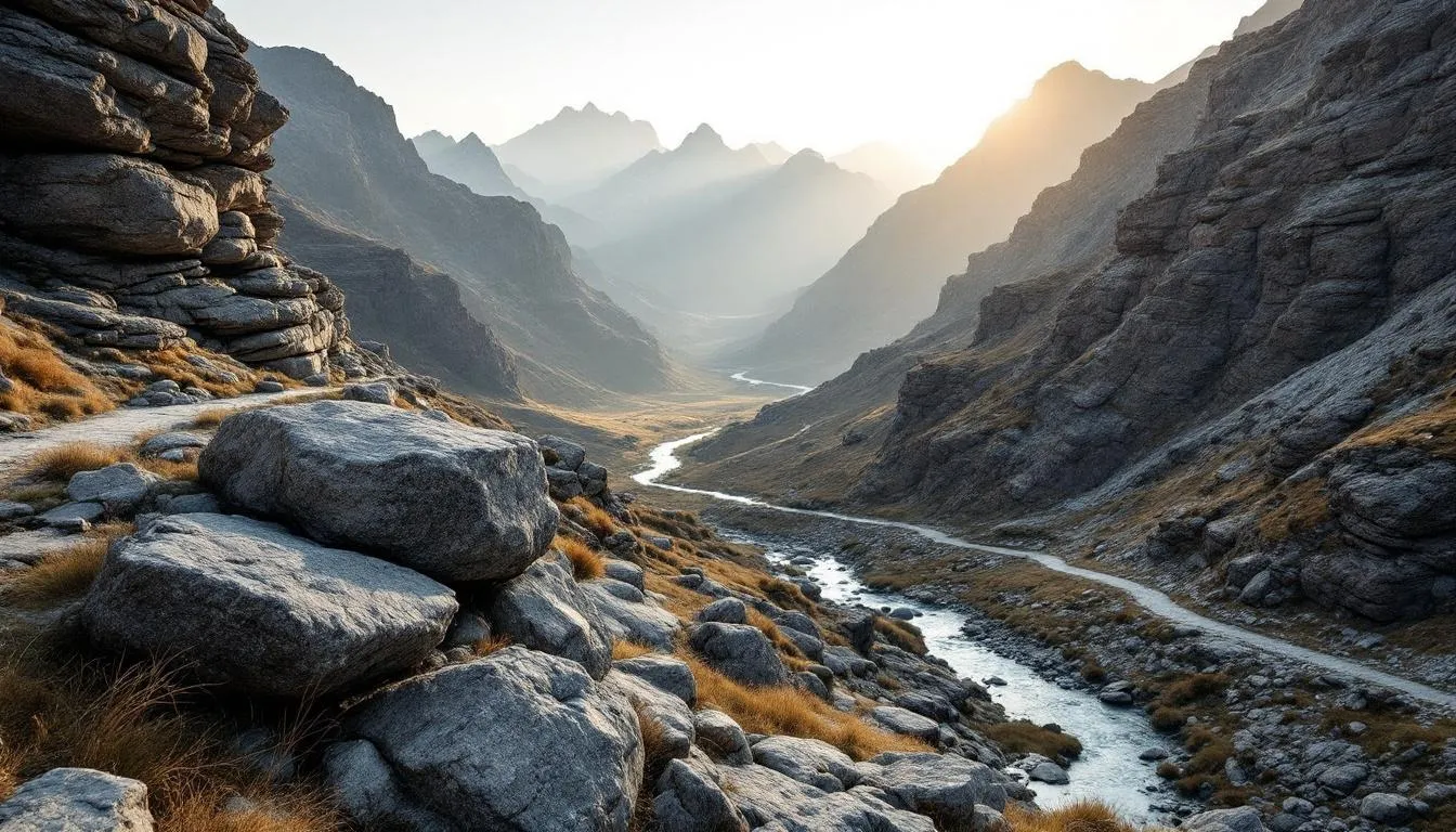
What Is Topography?
Topography is the study and detailed description of the surface features of an area — its elevation, slope, relief, and the position of natural and human-made features. In simpler terms, it’s the science of measuring and mapping what the ground actually looks like in three dimensions.
Why the Shape of the Ground Matters
You might not think about topography on a daily basis, but it quietly shapes almost everything about where and how people live. The topography of a region determines where rivers flow, where cities get built, which areas flood, how armies fight, where cell towers go, and whether your backyard drains properly after a rainstorm.
Consider this: every major city on Earth sits where it does partly because of topography. Rome was built on seven hills for defense. New York grew around a deep natural harbor. Denver sits at the western edge of the Great Plains where the Rocky Mountains begin — a natural stopping point on westward journeys. The shape of the land came first; everything else followed.
And the importance isn’t just historical. Modern civil engineering projects — highways, dams, airports, pipelines — all begin with topographic surveys. You can’t design a road without knowing the elevation profile. You can’t plan a drainage system without understanding slope. You can’t site a wind farm without knowing the terrain’s effect on airflow.
The U.S. Geological Survey has been mapping American topography since 1879, producing over 55,000 individual topographic map sheets that cover the entire country. That effort — spanning nearly 150 years — gives you a sense of how much data is needed to describe the shape of just one country.
Topographic Maps: Reading the Field on Paper
The topographic map is one of the most elegant inventions in the history of cartography. The challenge is fundamental: how do you represent a three-dimensional field on a flat, two-dimensional sheet of paper?
Contour Lines: The Key to Everything
The solution — developed in the 18th century and refined ever since — is contour lines. A contour line connects all points that share the same elevation. Imagine you could slice a mountain horizontally at regular intervals and trace where each slice meets the ground. Stack those traces on a flat map, and you have a contour representation.
Here’s what makes contour lines powerful:
- Spacing tells you steepness. Lines packed tightly together mean steep terrain. Lines spread far apart indicate gentle slopes or flat ground. A cliff shows up as lines nearly touching or overlapping.
- Shape tells you landform. Concentric closed loops indicate a hilltop. V-shapes pointing upstream mark valleys. U-shapes suggest ridges. A saddle (the low point between two peaks) shows up as an hourglass-shaped pattern in the contour lines.
- Index contours provide reference. Every fifth contour line is drawn thicker and labeled with its elevation, making it easy to calculate heights without counting every line.
The vertical distance between consecutive contour lines is called the contour interval. On USGS 7.5-minute quadrangle maps (the standard topographic map series for the United States), the contour interval is typically 10, 20, or 40 feet, depending on the terrain. Flat coastal plains use smaller intervals; mountainous areas use larger ones.
What Else Is on a Topo Map?
Topographic maps show far more than elevation. Standard USGS maps include:
- Hydrography — rivers, streams, lakes, wetlands, springs (shown in blue)
- Vegetation — forested areas appear in green tints
- Transportation — roads, trails, railroads (black and red)
- Boundaries — political borders, public land boundaries
- Structures — buildings, towers, mines, cemeteries
- Survey markers — benchmark locations with precise elevation data
Each of these layers is carefully overlaid so that the map tells a complete story about the field. A practiced map reader can look at a USGS quad and visualize the terrain in three dimensions — seeing the ridges, valleys, drainage patterns, and human settlement as a coherent picture.
How Topographic Data Gets Collected
Measuring the shape of the Earth has gone from chain-and-compass fieldwork to satellite-based systems that can map entire continents in days. The evolution is remarkable.
Traditional Surveying
For centuries, topographic surveying meant sending teams into the field with measuring instruments. They’d establish baselines, measure angles with theodolites, determine elevations with spirit levels, and painstakingly record thousands of data points. A single USGS topographic map sheet could take a field crew months or even years to complete.
The work was physically grueling. Early survey teams hauled heavy equipment up mountains, across deserts, and through dense forests. The Great Trigonometrical Survey of India (1802-1871) — which measured the height of Mount Everest and mapped the entire subcontinent — was one of the largest scientific undertakings of the 19th century. Workers died from malaria, tiger attacks, and sheer exhaustion.
Aerial Photogrammetry
The invention of aircraft changed everything. By the 1930s, stereoscopic aerial photography became the primary method for creating topographic maps. Two overlapping photographs taken from slightly different positions (mimicking human binocular vision) could be viewed through a stereoscope to perceive depth. Specialized instruments called stereoplotters allowed cartographers to trace contour lines directly from the 3D image.
Photogrammetry dramatically accelerated mapping. What took a field crew months could be accomplished in weeks from an office. The USGS completed its coverage of the contiguous United States primarily through aerial photogrammetry during the mid-20th century.
Satellite Remote Sensing
The space age opened up global topographic mapping. NASA’s Shuttle Radar Topography Mission (SRTM) in February 2000 was a watershed moment. Over 11 days, the Space Shuttle Endeavour used radar interferometry to map the topography of 80% of Earth’s land surface between 60 degrees north and 56 degrees south latitude. The resulting dataset — at approximately 30-meter resolution globally — remains one of the most widely used topographic datasets in the world.
Other satellite systems have followed. Japan’s ALOS satellite, the European Copernicus program, and commercial satellites from companies like Maxar produce increasingly detailed elevation data. The NASA SRTM mission page documents a dataset that has been downloaded millions of times by researchers worldwide.
LiDAR: The Current Gold Standard
LiDAR (Light Detection and Ranging) has become the preferred technology for high-resolution topographic mapping. An airborne LiDAR system fires rapid laser pulses toward the ground — hundreds of thousands per second — and measures how long each pulse takes to return. Combined with precise GPS positioning and inertial measurement, this produces extraordinarily detailed 3D point clouds of the terrain.
The beauty of LiDAR is that laser pulses can penetrate forest canopy. Multiple returns from a single pulse can separate the treetop, understory, and bare ground surface, allowing mappers to see the actual terrain beneath dense vegetation. This capability was limited or impossible with older methods.
The USGS 3D Elevation Program (3DEP) aims to provide LiDAR coverage of the entire United States at a resolution of at least 2 points per square meter. As of 2024, over 85% of the country has been mapped. The resulting data supports applications from flood modeling to archaeological discovery — LiDAR has revealed previously unknown Maya cities hidden beneath Guatemalan jungle, and ancient Roman roads buried under English farmland.
Digital Elevation Models: Topography Goes Digital
Paper maps are beautiful but limited. Digital Elevation Models (DEMs) represent topography as numerical grids — essentially spreadsheets where each cell contains an elevation value. This seemingly simple format enables powerful analysis that would be impossible with paper.
What You Can Do with a DEM
Give a computer scientist a DEM and they can calculate:
- Slope at every point (critical for erosion modeling, construction, and agriculture)
- Aspect — which direction each slope faces (matters for solar energy, vegetation patterns, and snowmelt)
- Drainage networks — where water will flow and accumulate
- Viewsheds — what’s visible from any given point (used in telecommunications, military planning, and scenic protection)
- Volume calculations — how much earth needs to be moved for a construction project
- Flood inundation — which areas will be underwater at different water levels
These calculations happen in Geographic Information Systems (GIS), software platforms that analyze and visualize spatial data. A flood modeler, for example, can combine a high-resolution DEM with rainfall data and river flow measurements to predict exactly which buildings and roads will flood during a 100-year storm event. Insurance companies, emergency managers, and urban planners all depend on this kind of analysis.
Resolution Matters
The usefulness of a DEM depends heavily on its resolution. SRTM data at 30-meter resolution is fine for regional planning but useless for designing a building foundation. LiDAR-derived DEMs at 1-meter resolution can show individual drainage ditches and building footprints. Some engineering projects use survey-grade DEMs at centimeter resolution.
There’s always a trade-off between resolution, coverage area, and data volume. A 1-meter DEM of a single county might be several gigabytes. The same resolution for an entire state could be terabytes. Managing and processing this data requires serious computing power, which is why cloud-based GIS platforms have become essential tools.
Topography and the Natural World
The shape of the land doesn’t just affect human activities — it fundamentally controls natural systems.
Climate and Weather
Mountains force air masses upward, causing them to cool and drop moisture on the windward side. This orographic effect is why the western slopes of the Cascades in Washington state receive over 100 inches of rain annually, while the eastern side — just miles away — gets less than 10 inches. The topography creates the rain shadow. Climatology is inseparable from topography.
Valleys trap cold air (cold air pooling), creating frost pockets that affect agriculture and temperature patterns. Coastal topography influences fog patterns. Mountain passes channel winds. Every weather forecast, in some way, accounts for terrain.
Hydrology
Topography is the primary control on where water goes. The simple principle is gravity: water flows downhill, following the steepest available path. The pattern of ridges and valleys defines watersheds — areas where all precipitation drains to a common outlet. The Mississippi River watershed, for example, covers 1.24 million square miles across 31 states, all defined by topography.
Stream patterns are diagnostic of underlying geology and topography. Dendritic (tree-like) patterns develop on uniform slopes. Trellis patterns form on folded rock layers. Radial patterns emerge from volcanic cones. A trained geomorphologist can read the geological history of a region just from its drainage pattern on a topographic map.
Ecology
Elevation, slope, and aspect create microclimates that determine which species live where. A south-facing slope in the Northern Hemisphere receives more solar radiation than a north-facing slope, making it warmer and drier. This can mean the difference between grassland and forest — or between one tree species and another — over a distance of just a few hundred meters.
Mountain topography creates elevation zones, each with distinct ecosystems. In the tropics, you can travel from tropical rainforest to alpine tundra simply by going uphill. The same vertical distance in the mountains spans climatic conditions equivalent to thousands of miles of horizontal distance at sea level.
Topography in Engineering and Planning
Virtually every engineering project begins with a topographic survey. The data drives decisions worth millions — sometimes billions — of dollars.
Road and Highway Design
Highway engineers use topographic profiles to plan routes that minimize earthwork (the expensive process of cutting through hills and filling valleys). The ideal road maintains a gentle, consistent grade. Steep grades increase construction costs, fuel consumption, and accident rates. Mountain highways often follow natural contours, with switchbacks added where grades would otherwise be too steep.
Dam and Reservoir Siting
A dam’s location is determined almost entirely by topography. Engineers need a narrow valley with impermeable bedrock (for the dam itself) and a wide basin behind it (for the reservoir). Topographic analysis calculates the storage volume at different water levels, identifies areas that will be flooded, and determines the watershed area that will feed the reservoir.
Urban Planning and Flood Management
Cities that ignore topography pay the price. Houston, Texas — built on a flat coastal plain with clay soils — experiences devastating floods partly because there’s nowhere for the water to go. The topography offers almost no natural drainage relief. In contrast, cities built on moderate slopes tend to drain naturally, though they face different challenges like erosion and landslides.
Modern flood management uses high-resolution topographic data to designate flood zones, design stormwater systems, and plan evacuation routes. The NOAA National Geodetic Survey maintains the vertical reference framework that all of these calculations depend on. Without accurate elevation data, a flood map is just a guess.
Military Topography: Terrain as Weapon and Shield
Topography has shaped military strategy since armies first took the field. High ground provides observation and fields of fire. Ridges and defiles channel movement. Rivers and mountains create natural barriers.
The Battle of Gettysburg (1863) was largely a fight over topographic features — Cemetery Ridge, Little Round Top, and Devil’s Den. The Union army’s position on higher ground gave them a decisive advantage that contributed to a Confederate defeat considered the turning point of the American Civil War.
Modern militaries invest heavily in topographic intelligence. Terrain analysis — combining elevation data with land cover, soil type, and hydrology — determines where vehicles can travel, where helicopters can land, and where defensive positions are most effective. The U.S. National Geospatial-Intelligence Agency (NGA) employs thousands of people to produce topographic and geospatial data for military operations worldwide.
Undersea Topography: Bathymetry
Topography doesn’t stop at the waterline. The shape of the ocean floor — called bathymetry — is measured using sonar (sound navigation and ranging) rather than light or radar. Ships emit sound pulses and measure the time it takes for echoes to return from the seafloor.
What we’ve found is staggering. The Mid-Atlantic Ridge runs 10,000 miles down the center of the Atlantic Ocean. The Mariana Trench plunges to 36,000 feet — deeper than Everest is tall. Submarine canyons rival the Grand Canyon in scale. And we’ve only mapped about 25% of the ocean floor at high resolution. We literally know the topography of Mars better than we know the bottom of our own oceans.
Bathymetric data matters for submarine navigation, cable and pipeline routing, fisheries management, tsunami modeling, and understanding plate tectonics. The Seabed 2030 project, a collaboration under the United Nations, aims to map the entire ocean floor by — you guessed it — 2030.
The Future of Topographic Science
Several developments are pushing topographic science forward at an accelerating pace.
Drone-based mapping is democratizing high-resolution topographic data. A $2,000 drone with a camera can produce centimeter-resolution elevation models of small sites — work that would have required a $50,000 aerial survey a decade ago. Farmers, archaeologists, construction managers, and environmental consultants are all using drone topography routinely.
Ice-penetrating radar is mapping the topography beneath Earth’s ice sheets for the first time. The BedMachine project has revealed the sub-glacial terrain of Greenland and Antarctica — critical data for predicting how ice sheets will respond to warming and how much sea levels will rise.
Planetary topography extends these techniques beyond Earth. NASA’s Mars Orbiter Laser Altimeter (MOLA) mapped Mars at a resolution that surpasses much of Earth’s ocean floor data. The Lunar Reconnaissance Orbiter has produced topographic maps of the Moon at 2-meter resolution. Understanding the topography of other worlds is essential for landing spacecraft and planning future human missions.
Real-time terrain monitoring using persistent satellite radar (InSAR) can detect ground surface changes of just millimeters. This technology monitors volcanic uplift, land subsidence from groundwater pumping, slope movements that precede landslides, and even the subtle deformation of buildings and bridges.
Topography — the straightforward question of “what does the ground look like?” — turns out to be one of the most fundamental datasets in science and engineering. Nearly every question about the physical world, from “will this area flood?” to “can we build here?” to “what lived here 10,000 years ago?”, starts with understanding the shape of the land.
Frequently Asked Questions
What is the difference between topography and geography?
Geography is the broad study of Earth's lands, features, inhabitants, and phenomena. Topography is a specific subset that focuses on the shape and features of the land surface — its elevation, slope, and physical forms. You could think of topography as geography zoomed in on terrain. A geographer studies everything from climate to culture; a topographer measures hills, valleys, and drainage patterns.
How do you read contour lines on a topographic map?
Contour lines connect points of equal elevation. When lines are close together, the terrain is steep. When they're far apart, the land is relatively flat. Every fifth line (called an index contour) is thicker and labeled with its elevation. Closed loops indicate hilltops or depressions — depressions are marked with small tick marks pointing inward. V-shaped contours pointing uphill indicate valleys or stream channels.
What is a Digital Elevation Model (DEM)?
A DEM is a 3D digital representation of terrain elevation, stored as a grid of numbers where each cell contains an elevation value. DEMs are created from satellite radar, LiDAR, or stereo aerial photography. They're used for flood modeling, slope analysis, line-of-sight calculations, and countless engineering and scientific applications. Common sources include the USGS 3DEP program and NASA's SRTM data.
What is the contour interval?
The contour interval is the vertical distance between consecutive contour lines on a topographic map. For example, if the contour interval is 20 feet, each line represents a 20-foot change in elevation from the previous line. Steeper terrain typically uses larger intervals to avoid overcrowding, while flat areas use smaller intervals to show subtle changes.
Why is topography important for construction?
Topography determines nearly every major decision in construction projects. It affects where buildings can be placed, how water will drain, where roads should go, how much earthwork (cut and fill) is needed, and whether a site is prone to flooding or landslides. Building codes and zoning regulations often reference topographic data to establish flood zones and buildable areas.
Further Reading
Cite this article
APA
WhatIs.site. (2025). What Is Topography?. Retrieved May 27, 2026, from https://whatis.site/topography MLA
"What Is Topography?." WhatIs.site, July 15, 2025, https://whatis.site/topography. Accessed May 27, 2026. Chicago
WhatIs.site. "What Is Topography?." Last modified May 12, 2026. https://whatis.site/topography. HTML
<a href="https://whatis.site/topography">What Is Topography?</a> — WhatIs.site Related Articles
What Is Cartography?
Cartography is the science, art, and technology of creating maps — visual representations of spatial relationships that communicate geographic information.
scienceWhat Is Geography?
Geography is the scientific study of places, spaces, and the relationships between people and their environments.
technologyWhat Is Civil Engineering?
Civil engineering designs and builds infrastructure like roads, bridges, and buildings. Learn about its branches, history, and how it shapes daily life.
scienceWhat Is Climatology?
Climatology is the scientific study of climate patterns, causes, and changes over time. Learn how it differs from meteorology and why it matters today.
scienceWhat Is Teratology?
Teratology is the study of birth defects and congenital malformations, including their causes, mechanisms, and prevention. Learn about teratogens and fetal.