Table of Contents
What Is Sedimentology?
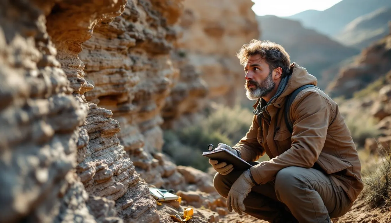
Sedimentology is the branch of geology that studies sediments—particles of rock, mineral, and organic material—and the processes by which they are produced, transported, deposited, and eventually transformed into sedimentary rock. It’s the science of reading Earth’s surface history, because sedimentary rocks are essentially a diary written by wind, water, ice, and gravity over billions of years.
About 73% of Earth’s land surface is covered by sedimentary rocks. Every sandstone cliff, every limestone cave, every shale deposit started as loose grains or dissolved minerals that accumulated somewhere—a beach, a river delta, the deep ocean floor—and were gradually compressed and cemented into solid rock. Understanding how that happened tells us about ancient oceans, vanished mountain ranges, shifting continents, and climates radically different from today’s.
Where Sediment Comes From
Before there can be deposition, there must be destruction. Sediment begins its existence when existing rocks are broken down through weathering and erosion.
Weathering: Breaking Rock Apart
Physical (mechanical) weathering fractures rock without changing its chemical composition. Freeze-thaw cycles are the most effective mechanism in cold climates: water seeps into cracks, freezes and expands by about 9%, widening the crack. After thousands of cycles, solid cliff faces crumble into angular fragments. Root growth, salt crystal growth, thermal expansion, and abrasion all contribute.
Chemical weathering dissolves or chemically alters minerals. Water—especially slightly acidic rainwater (all rain is mildly acidic due to dissolved CO2)—reacts with feldspars to produce clay minerals, dissolves limestone, and oxidizes iron-bearing minerals. In warm, humid climates, chemical weathering dominates. A granite outcrop in the tropics weathers into a thick mantle of clay and quartz sand within a few million years. The same granite in Antarctica might survive virtually unchanged for tens of millions.
Biological weathering involves organisms: lichens producing acid, burrowing animals mixing soil, and plant roots prying apart rock. These biological processes often work alongside chemical and physical mechanisms.
The products of weathering depend on the parent rock and the climate. Granite weathers into quartz sand (resistant), clay minerals (from feldspar breakdown), and dissolved silica and ions. Limestone dissolves almost entirely, leaving little solid residue. Basalt weathers into clay-rich soils. Chemistry controls which minerals survive and which dissolve or alter.
Erosion and Transport
Weathering loosens material. Erosion picks it up and moves it. The agents of transport are:
Rivers carry the majority of sediment from land to sea—roughly 20 billion tonnes per year globally. Dissolved load (ions in solution), suspended load (fine particles held aloft by turbulence), and bedload (larger grains rolling, sliding, and bouncing along the bottom) all move downstream. The Amazon alone delivers about 1.2 billion tonnes of sediment to the Atlantic annually.
Wind carries fine sand and dust, sometimes thousands of kilometers. Saharan dust reaches the Caribbean, fertilizing the Amazon rainforest along the way. Wind-transported sediment is typically well-sorted (uniform in size) and well-rounded because constant collisions between grains wear off sharp edges.
Glaciers transport everything from house-sized boulders to microscopic flour (rock ground to powder by the glacier’s base). Glacial sediments are notoriously poorly sorted—a jumbled mix of all sizes dumped together as the ice melts.
Gravity drives landslides, debris flows, and turbidity currents (underwater avalanches of sediment-laden water). Gravity-driven deposits can be massive—single turbidity current deposits have been traced across thousands of square kilometers of ocean floor.
Ocean currents and waves redistribute sediment along coastlines and across continental shelves. Longshore drift—the gradual movement of sand along a beach by waves approaching at an angle—builds spits, barrier islands, and reshapes entire coastlines over decades.
Depositional Environments: Where Sediment Settles
The conditions under which sediment is deposited leave distinctive signatures in the resulting rock. Sedimentologists read these signatures to reconstruct ancient environments—a practice sometimes called “reading the rocks.”
Continental Environments
Fluvial (river) systems deposit sediment in channels, floodplains, and deltas. River channel deposits are typically coarse (sand and gravel), cross-bedded (layers at angles to each other from migrating dunes on the channel floor), and elongated. Floodplain deposits are fine-grained (mud and silt) and laterally extensive. Ancient river deposits are important oil and gas reservoirs because the porous sand channels are enclosed by impermeable floodplain muds.
Desert (aeolian) environments produce well-sorted, well-rounded sand with distinctive large-scale cross-bedding created by migrating dunes. The Navajo Sandstone in Utah—those stunning red and white cliffs—is an ancient desert sand sea (erg) preserved in stone. The cross-bedding tells you exactly which direction the wind was blowing 190 million years ago.
Glacial environments produce diamictite (poorly sorted mixtures of all grain sizes) and finely laminated glacial lake deposits called varves. Each varve couplet—a coarse summer layer and a fine winter layer—represents one year, making them natural clocks for dating glacial events. Climatology researchers use ancient glacial deposits to reconstruct ice age timing and extent.
Lake (lacustrine) environments produce fine-grained, often organic-rich sediments. Large ancient lakes are the source of some major oil shale deposits, including the Green River Formation in Wyoming and Colorado.
Transitional (Coastal) Environments
Deltas form where rivers meet standing water and dump their sediment load. The Mississippi Delta, the Nile Delta, and the Ganges-Brahmaputra Delta are modern examples. Delta deposits are typically coarsening-upward—fine prodelta muds at the base, overlain by delta front sands, topped by distributary channel sands. Ancient delta deposits are major hydrocarbon reservoirs worldwide.
Beaches and barrier islands produce well-sorted, clean sand with low-angle planar bedding and distinctive assemblages of shell fragments. These environments are highly active—storms reshape entire beach profiles in hours.
Tidal flats are broad, flat areas alternately exposed and submerged by tides. They produce characteristic fine-grained sediments with mud cracks (from drying during exposure), ripple marks, and elaborate biological features (burrows, trails, feeding traces). Tidal flat deposits are common in the geological record and often contain excellent examples of trace fossils.
Marine Environments
Continental shelves (0-200m depth) receive terrigenous sediment from land and host abundant biological production. Shelf deposits range from nearshore sand to offshore mud, often with abundant fossil content.
Carbonate platforms in warm, shallow, tropical seas produce limestone and dolomite through biological and chemical precipitation of calcium carbonate. Coral reef ecology plays a direct role—reef organisms (corals, algae, foraminifera, mollusks) build massive carbonate structures that become limestone after burial. Ancient carbonate platforms contain some of the world’s largest oil and gas reservoirs.
Deep ocean environments accumulate extremely slowly—millimeters per thousand years. Pelagic sediments include biogenic ooze (microscopic shells of foraminifera and radiolaria), volcanic ash, wind-blown dust, and very slowly precipitated authigenic minerals. These fine-grained sediments preserve a remarkably complete record of ocean chemistry, temperature, and biology stretching back tens of millions of years.
Sedimentary Structures: The Clues Inside the Rock
Sedimentary structures are physical features within sedimentary rocks that record the conditions during and shortly after deposition. They’re the primary diagnostic tools for interpreting ancient environments.
Primary Structures (Formed During Deposition)
Cross-bedding consists of inclined layers within a bed, formed by sediment deposited on the downstream face of migrating ripples or dunes. The angle and scale of cross-beds indicate the flow speed and depth. Small ripple cross-bedding (a few centimeters thick) indicates gentle currents. Large-scale cross-bedding in sandstone (meters thick) indicates strong winds or deep, fast-flowing water.
Graded bedding shows a systematic change in grain size from bottom to top—typically coarse at the base and fining upward. This forms when a mixture of grain sizes settles from suspension, with larger, heavier grains settling first. Graded beds are characteristic of turbidity current deposits (turbidites) and storm deposits.
Ripple marks on bedding surfaces record the flow of water or wind. Symmetric ripples (oscillation ripples) indicate wave action. Asymmetric ripples indicate unidirectional current, with the steep face pointing downstream. Ripple marks on a sandstone surface 400 million years old look identical to ripples forming on a beach today—same physics, same result.
Mudcracks indicate that wet sediment was exposed to air and dried, shrinking and cracking into polygonal patterns. They’re reliable indicators of intermittent subaerial exposure—tidal flats, seasonal lake margins, floodplains.
Biogenic Structures
Trace fossils (ichnofossils) are the tracks, trails, burrows, and feeding structures of organisms preserved in sediment. Unlike body fossils (shells, bones), trace fossils record behavior. They can’t be transported—a burrow in sandstone means an organism lived right there. The assemblage of trace fossils indicates the depositional environment: deep marine communities produce different trace fossil suites than nearshore or terrestrial communities.
Bioturbation is the mixing of sediment by burrowing organisms. Intense bioturbation destroys physical structures (bedding, lamination), producing a homogenized sediment. The degree of bioturbation indicates how favorable conditions were for benthic (bottom-dwelling) life—oxygen levels, sedimentation rate, and substrate stability all play roles.
From Sediment to Rock: Diagenesis
The transformation of loose sediment into solid rock—lithification—is part of a broader set of post-depositional processes called diagenesis. These processes begin at the surface and continue through burial to depths of several kilometers and temperatures up to about 200C (beyond which metamorphism takes over).
Compaction
Overlying sediment weight squeezes buried layers, expelling water and reducing pore space. Muds compact dramatically—a mud deposit may lose 50-70% of its thickness through compaction. Sands compact less because the rigid quartz grains resist compression. Compaction is the main reason why sedimentary basins subside over time, accommodating progressively more sediment.
Cementation
Minerals dissolved in pore water precipitate in the spaces between grains, binding them together. Common cements include:
- Calcite (CaCO3): The most common cement in sedimentary rocks. Precipitates from calcium-rich groundwater, especially in marine-influenced sediments.
- Silica (SiO2): Creates extremely hard, durable sandstones. Silica cement often comes from dissolved diatom shells, volcanic ash, or pressure dissolution of quartz grains.
- Iron oxides (hematite, goethite): Responsible for the red and yellow colors of many sandstones. The red rocks of the American Southwest owe their color entirely to iron oxide cement.
Dissolution and Replacement
Some minerals dissolve during diagenesis while others precipitate. Aragonite (a form of calcium carbonate secreted by many marine organisms) is unstable and dissolves, often being replaced by calcite. Fossils may be replaced by silica, pyrite, or other minerals, sometimes preserving exquisite detail.
Dolomitization—the replacement of limestone (calcite) by dolomite (CaMgCO3)—is one of sedimentology’s persistent puzzles. Massive dolomite formations are common in the geological record, but the conditions that produce dolomite at scale remain debated despite decades of research.
Practical Applications
Sedimentology isn’t purely academic. It has enormous economic and societal importance.
Petroleum Geology
Approximately 60% of the world’s oil and 40% of natural gas are found in sedimentary rocks. Sedimentologists characterize reservoir rocks (usually sandstones or carbonates with sufficient porosity and permeability to store and transmit fluids), source rocks (organic-rich shales and mudstones that generated the hydrocarbons), and seal rocks (impermeable layers that trap hydrocarbons). Understanding depositional environments is essential for predicting where these rock types occur in the subsurface.
Groundwater Resources
Sedimentary aquifers supply drinking water to billions of people. The porosity and permeability of these aquifers—controlled by grain size, sorting, and cementation—determine how much water they hold and how fast it flows. Sedimentological analysis helps locate and manage groundwater resources sustainably.
Coastal Management
Understanding sediment transport along coastlines is critical for managing erosion, planning coastal development, and responding to sea-level rise. Beach nourishment (adding sand to eroding beaches) requires detailed knowledge of sediment sources, transport pathways, and grain-size compatibility. Get the sediment wrong, and your expensive nourishment project washes away in the first storm.
Climate Science
Sedimentary records are among the most important archives of past climate. Ice cores, ocean sediment cores, lake sediment cores, and exposed sedimentary rock sequences provide continuous records of temperature, precipitation, atmospheric composition, and ocean circulation stretching back millions to billions of years. These records are indispensable for understanding natural climate variability and contextualizing modern climate change.
Geoarchaeology
Sedimentological techniques help archaeologists understand ancient human environments. What was the field like when a settlement was occupied? How did rivers change course? When did a lake dry up? Sediment analysis of archaeological sites provides environmental context that artifacts alone cannot.
Modern Methods
Sedimentology has been transformed by new analytical tools:
Core analysis from drilling provides direct samples of subsurface sedimentary sequences. Cores are logged (described in detail), photographed, sampled for geochemistry, and analyzed for porosity and permeability.
Seismic stratigraphy uses acoustic waves to image subsurface sedimentary layers. Modern 3D seismic surveys can reveal ancient river channels, reef systems, and depositional geometries buried kilometers below the surface—without drilling a single well.
Stable isotope geochemistry (oxygen-18, carbon-13, and others) extracted from sedimentary minerals and fossils reveals past temperatures, water sources, biological productivity, and atmospheric composition.
Detrital zircon geochronology dates individual sand grains by measuring uranium-lead ratios in zircon crystals. This reveals the source areas of ancient sediments and the tectonic history of the regions that supplied them.
Numerical modeling simulates sediment transport and deposition processes, testing hypotheses about ancient environments and predicting subsurface geological architecture for resource exploration.
Reading the Rocks
The deepest satisfaction of sedimentology comes from reading a rock outcrop the way you might read a book. The grain size tells you about transport energy. The sorting tells you about the transport mechanism. The sedimentary structures tell you about flow conditions. The fossils tell you about the biological community. The mineralogy tells you about the source area and climate. The geometry tells you about the depositional environment.
Put it all together, and a nondescript cliff face becomes a vivid scene: a river meandering across a floodplain 300 million years ago, flooding periodically to deposit sheets of mud, building sandy point bars on the inside of its bends, occasionally burying forests that became coal seams. The evidence is right there in the rock—layers of sand with epsilon cross-bedding (point bar), interbedded with dark mudstones (floodplain), capped by coal (buried swamp), punctuated by fossil tree stumps in growth position.
That ability to reconstruct vanished worlds from physical evidence is what makes sedimentology so rewarding. The rocks aren’t silent—they’re telling an incredibly detailed story. You just need to learn the language.
Frequently Asked Questions
What's the difference between sedimentology and stratigraphy?
Sedimentology focuses on the processes that create, transport, and deposit sediments—how grains move, what environments produce which sediment types, and how loose sediment becomes rock. Stratigraphy focuses on the layered arrangement of sedimentary rocks in time and space—how rock layers relate to each other, what age they are, and how they correlate between locations. The two fields overlap heavily, and most researchers work in both, but the emphasis differs: sedimentology is process-focused, stratigraphy is time-and-arrangement-focused.
How does loose sediment become solid rock?
The process is called lithification and involves two main mechanisms: compaction and cementation. Compaction occurs as overlying sediment weight squeezes out water and pore space, pressing grains closer together. Cementation occurs when minerals dissolved in groundwater precipitate in the remaining pore spaces, gluing grains together. Common cements include calcite, silica (quartz), and iron oxides. Lithification can take thousands to millions of years depending on conditions.
Why do sedimentary rocks form layers?
Layers (called beds or strata) form because sediment deposition occurs in episodes separated by changes in conditions. A flood deposits a layer of sand, then calm water deposits a layer of mud. Sea level rises, changing the shoreline position and the type of sediment deposited. Each change in conditions creates a new layer. The principle of superposition states that in undisturbed sequences, older layers are on the bottom and younger layers on top—giving us a timeline of Earth's history.
What percentage of Earth's surface is covered by sedimentary rock?
About 73% of Earth's land surface is covered by sedimentary rocks, despite the fact that sedimentary rocks make up only about 8% of the total volume of the crust. This means sedimentary rocks form a relatively thin veneer over the igneous and metamorphic rocks that make up the bulk of the crust. On the ocean floor, sediment covers virtually the entire surface, reaching thicknesses of several kilometers near continental margins.
Can sedimentary rocks tell us about ancient climates?
Absolutely. Sedimentary rocks are one of the best records of past climates on Earth. Glacial deposits (tillites) indicate ice ages. Evaporite minerals (salt, gypsum) indicate hot, arid conditions. Coal deposits indicate warm, swampy environments. Reef limestones indicate warm, shallow tropical seas. Oxygen isotope ratios in marine fossils record past ocean temperatures. By reading the sedimentary record, geologists have reconstructed Earth's climate history spanning billions of years.
Further Reading
Cite this article
APA
WhatIs.site. (2026). What Is Sedimentology?. Retrieved May 27, 2026, from https://whatis.site/sedimentology MLA
"What Is Sedimentology?." WhatIs.site, March 6, 2026, https://whatis.site/sedimentology. Accessed May 27, 2026. Chicago
WhatIs.site. "What Is Sedimentology?." Last modified May 12, 2026. https://whatis.site/sedimentology. HTML
<a href="https://whatis.site/sedimentology">What Is Sedimentology?</a> — WhatIs.site Related Articles
What Is Chemistry?
Chemistry is the science of matter and how substances interact, bond, and transform. Learn about atoms, molecules, reactions, and why chemistry matters.
scienceWhat Is Climatology?
Climatology is the scientific study of climate patterns, causes, and changes over time. Learn how it differs from meteorology and why it matters today.
scienceWhat Is Coral Reef Ecology?
Coral reef ecology studies the complex relationships within reef ecosystems. Learn how corals build reefs, why they matter, and what threatens their survival.
scienceWhat Is Biology?
Biology is the scientific study of living organisms and life processes. Learn about cells, genetics, evolution, ecosystems, and the major branches of biology.
scienceWhat Is Cosmology?
Cosmology is the study of the universe's origin, structure, and fate. Learn about the Big Bang, dark matter, dark energy, and what we still don't understand.