Table of Contents
What Is Hydrology?
Hydrology is the scientific study of water’s movement, distribution, and quality across Earth and other planets. It tracks water from the moment it evaporates off an ocean surface, through its journey as atmospheric vapor and precipitation, into rivers and underground aquifers, and eventually back again. The field sits at the intersection of geology, environmental science, chemistry, and atmospheric science.

Why Water Science Matters More Than You Think
Here’s a number that should stop you cold: only 0.5% of Earth’s water is available as fresh, accessible liquid. The rest is locked in oceans (96.5%), ice caps (1.74%), or deep underground where we can’t easily reach it. That tiny fraction sustains every farm, every city, every ecosystem on the planet.
Hydrology exists because we need to understand — really, truly understand — how that 0.5% moves around. Where does it go after it rains? How fast does a river rise during a storm? Will this aquifer still have water in 50 years if a city keeps pumping from it? These aren’t academic questions. They’re survival questions.
And they’re getting harder to answer. Rainfall patterns that held steady for centuries are shifting. Glaciers that fed rivers for thousands of years are retreating. Aquifers that took millennia to fill are being drained in decades. Hydrology is the discipline trying to make sense of all this — and figure out what to do about it.
The Water Cycle: More Complicated Than You Learned in School
You probably remember the basic water cycle diagram from grade school: evaporation, condensation, precipitation, collection. Arrows going in a circle. Simple.
The real water cycle is fantastically more complicated.
Evaporation and Transpiration
Water enters the atmosphere through two main routes. Evaporation is straightforward — solar energy heats surface water in oceans, lakes, and rivers, turning liquid into vapor. About 86% of atmospheric moisture comes from ocean evaporation.
But here’s what most people miss: transpiration. Plants pull water from the soil through their roots, move it up through their stems, and release it as vapor through tiny pores in their leaves called stomata. A single large oak tree can transpire over 40,000 gallons of water per year. The Amazon rainforest generates roughly half its own rainfall through transpiration — it literally creates its own weather.
Hydrologists combine these into “evapotranspiration,” and measuring it accurately is one of the field’s persistent challenges. You can’t just put a rain gauge on the ground and read it backward. Evapotranspiration depends on temperature, humidity, wind speed, solar radiation, soil moisture, vegetation type, and a dozen other variables.
Precipitation: Not Just Rain
When atmospheric moisture condenses and falls, we call it precipitation. Rain, snow, sleet, hail, freezing rain — each behaves differently when it hits the ground. Snow might sit on a mountain for months before melting in spring. Rain on saturated soil runs off immediately. Rain on dry sand infiltrates within seconds.
The spatial distribution matters enormously. A thunderstorm might dump 3 inches of rain on one neighborhood and nothing on a town 5 miles away. Hydrologists use networks of rain gauges, weather radar, and satellite data to estimate precipitation across entire watersheds — and even with all that technology, getting accurate numbers remains difficult.
One critical concept: rainfall intensity. Two inches of rain over 24 hours is a gentle, soaking rain. Two inches in 30 minutes is a flash flood. Same total water, wildly different consequences. Hydrology cares deeply about not just how much rain falls, but how fast.
Infiltration and Soil Water
When water hits the ground, it either infiltrates (soaks in) or runs off. What determines the split? Soil type, slope, vegetation cover, existing soil moisture, and surface conditions.
Sandy soils can absorb water at rates exceeding 1 inch per hour. Clay soils? Maybe 0.1 inches per hour. Compacted urban surfaces — parking lots, roads, rooftops — absorb essentially nothing. This is why a 1-acre parking lot generates 16 times more runoff than a 1-acre meadow during the same storm.
Water that infiltrates doesn’t just stop. It continues moving downward through the soil profile, driven by gravity and capillary forces. Some gets absorbed by plant roots. Some clings to soil particles and stays in the “unsaturated zone.” Some keeps descending until it reaches the water table and joins the groundwater system.
This process is called percolation, and it’s agonizingly slow compared to surface water flow. Water might take days, weeks, or even years to travel from the surface to a deep aquifer. That lag time has enormous implications for water supply planning.
Surface Runoff and Streamflow
Water that doesn’t infiltrate flows across the surface, gathering in rivulets, then streams, then rivers. Hydrologists describe this collection area as a watershed (or catchment, or drainage basin — same thing, different names depending on which country you’re in).
Every point on Earth’s land surface belongs to a watershed. Rain that falls on the western slope of a mountain might flow toward the Pacific Ocean, while rain falling 100 feet away on the eastern slope heads toward the Atlantic. The line dividing them is called a drainage divide.
Streamflow — the volume of water passing a point in a river per unit time — is one of hydrology’s most important measurements. The USGS operates over 10,000 stream gauging stations across the United States alone, many of them recording data continuously in real time. This network provides the foundation for flood forecasting, water supply management, and ecological monitoring.
Streamflow has two main components: baseflow (groundwater seeping into the stream) and quickflow (recent rainfall or snowmelt running off the surface). During dry periods, a river runs entirely on baseflow. During storms, quickflow dominates and the river rises rapidly. Understanding this separation helps hydrologists predict how rivers will behave under different conditions.
Groundwater: The Hidden Reservoir
Beneath your feet, in the cracks and pores of rock and sediment, sits an enormous volume of water. Groundwater constitutes about 30% of all freshwater on Earth — roughly 100 times more than all the water in rivers and lakes combined.
Water underground fills geological formations called aquifers. Some aquifers are shallow — 20 or 30 feet down — and replenish quickly from surface infiltration. Others are deep, ancient formations containing water that fell as rain thousands of years ago.
The Ogallala Aquifer under the Great Plains of the United States is one of the world’s largest. It holds about 2.93 billion acre-feet of water and irrigates roughly 27% of the nation’s cropland. Problem is, farmers are pumping water out far faster than nature replenishes it. In parts of Kansas and Texas, the aquifer has dropped over 150 feet since intensive irrigation began in the 1950s. Some areas may run dry within a generation.
Hydrogeology — the study of groundwater specifically — uses well measurements, pumping tests, and computer models to understand how water moves through these underground systems. It’s critical work, because once you deplete an aquifer, you can’t just refill it. The geology may compact, permanently reducing its capacity. Contamination from surface pollutants can persist for decades or centuries.
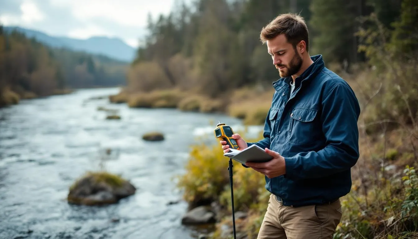
Measuring Water: Tools of the Trade
Hydrology depends on measurement. You can’t manage what you can’t quantify.
Stream Gauges and Flow Measurement
A stream gauge is deceptively simple: a sensor that measures water level (stage) at a specific point in a river. But translating stage into flow requires a “rating curve” — a relationship between water height and discharge that hydrologists develop through repeated measurements at different flow levels.
Modern gauges transmit data via satellite in near-real-time, feeding into flood warning systems and water management models. During Hurricane Harvey in 2017, USGS stream gauges provided critical data that guided evacuation decisions for millions of people in Houston.
Weather Radar and Remote Sensing
Doppler radar estimates rainfall intensity by measuring the reflectivity of precipitation particles in the atmosphere. Satellites like NASA’s Global Precipitation Measurement mission provide rainfall estimates over the entire planet — including oceans and remote areas where no ground-based gauges exist.
LiDAR (Light Detection and Ranging) creates detailed elevation maps that reveal drainage patterns, floodplain boundaries, and watershed divides with centimeter-scale precision. These datasets transform flood modeling from rough approximation to highly detailed simulation.
Groundwater Monitoring
Wells aren’t just for drinking water. Monitoring wells measure water table depth, water quality, and how aquifer levels change over time. The USGS maintains a network of over 20,000 monitoring wells across the United States.
Newer technologies include gravity measurements from the GRACE satellite mission, which can detect changes in underground water storage across entire continents by measuring slight variations in Earth’s gravitational field. These measurements revealed, among other things, that India’s groundwater was declining at a rate of about 4 centimeters per year — information impossible to gather from ground-based wells alone.
Floods: When Water Goes Wrong
Flooding is the most common natural disaster worldwide, and it’s not close. More people are affected by floods than by any other type of natural hazard.
How Floods Happen
The basic mechanism is simple: more water arrives at a location than can drain away. But the specifics vary enormously.
Riverine floods occur when sustained rainfall or rapid snowmelt overwhelms a river’s channel capacity. These floods build over hours or days, giving warning time. The Mississippi River flood of 1993 lasted months, inundating 30,000 square miles across nine states.
Flash floods happen when intense rainfall hits an area faster than the ground can absorb it or streams can carry it away. These are the deadly ones — water can rise 10 or 20 feet in minutes, catching people completely off guard. More than half of flood deaths in the United States involve vehicles driven into floodwater.
Coastal floods result from storm surge, high tides, or sea level rise pushing seawater onto land. Hurricane Katrina’s storm surge reached 28 feet in some areas of Mississippi in 2005.
Urban floods are increasingly common as cities expand. Concrete and asphalt replace permeable soil, dramatically increasing runoff. A city might experience serious flooding from a storm that would cause no problems in a rural area with the same rainfall.
Flood Forecasting and Management
Hydrologists build mathematical models of watersheds — digital representations that simulate how rainfall translates into streamflow. These models incorporate topography, soil types, land use, channel geometry, and real-time rainfall data to predict when and where flooding will occur.
The U.S. National Weather Service’s River Forecast Centers use these models to issue flood watches and warnings. The accuracy has improved dramatically over the decades, but uncertainty remains — especially for flash floods, where the time between rainfall and flooding may be just 30 to 60 minutes.
Flood management goes beyond prediction. Hydrologists design levees, retention basins, and floodways. They develop floodplain maps that determine building codes and insurance requirements. Increasingly, they advocate for “green infrastructure” — preserving wetlands, restoring floodplains, and using permeable surfaces — that works with water rather than against it.
Water Quality: The Other Half of Hydrology
Quantity is only half the story. What’s in the water matters just as much.
Natural Water Chemistry
All natural water contains dissolved substances. Rain picks up gases and particles from the atmosphere. Groundwater dissolves minerals from the rocks it passes through. River water carries sediment, organic matter, and dissolved salts.
Some of this is beneficial — minerals in drinking water provide essential nutrients. Some is neutral. Some is harmful. Arsenic occurs naturally in groundwater in parts of Bangladesh, affecting an estimated 35 to 77 million people. Fluoride concentrations in East African groundwater exceed safe levels in many areas.
Human Contamination
Then there’s what we add. Agricultural runoff carries fertilizers, pesticides, and animal waste into streams and groundwater. Industrial discharge introduces heavy metals, solvents, and synthetic chemicals. Urban runoff contributes oil, tire particles, and everything else that washes off streets and parking lots.
Nitrate contamination from agriculture is one of the most widespread groundwater quality problems globally. Excessive nitrate in drinking water causes methemoglobinemia (“blue baby syndrome”) in infants and has been linked to certain cancers in adults.
Emerging contaminants — pharmaceuticals, microplastics, PFAS (“forever chemicals”) — present new challenges. These substances weren’t on anyone’s radar 30 years ago, and conventional water treatment doesn’t always remove them. Hydrologists work alongside chemists and engineers to understand how these contaminants move through water systems and what concentrations pose health risks.
Watershed Management
The most effective water quality strategy is preventing contamination rather than treating it. Watershed management approaches consider the entire drainage area as a system — regulating land use, establishing buffer zones along streams, managing stormwater, and monitoring water quality at multiple points.
The Chesapeake Bay watershed, spanning 64,000 square miles across six states, is one of the most intensively studied examples. Decades of effort to reduce nutrient pollution from agriculture and urban runoff have produced measurable improvements, though the bay still falls short of water quality goals.
Hydrology and Climate Change
Climate change is rewriting the rules that hydrologists have relied on for decades. Historical data — the foundation of most hydrological analysis — may no longer predict the future.
Shifting Precipitation Patterns
Global warming increases atmospheric moisture content by about 7% per degree Celsius of warming (the Clausius-Clapeyron relation). This means more intense precipitation events — but also longer dry periods between them. The result is paradoxical: both more flooding and more drought.
The western United States is experiencing this firsthand. Winter snowpack — which historically served as a natural reservoir, storing water through winter and releasing it gradually through spring and summer — is declining. The Sierra Nevada snowpack in April 2015 was just 5% of its historical average, contributing to California’s worst drought in 1,200 years.
Glacier Retreat
Mountain glaciers worldwide are retreating. This matters hydrologically because glaciers act as water banks — storing precipitation as ice during wet or cold periods and releasing it as meltwater during warm, dry periods. Rivers fed by glaciers in the Himalayas, Andes, and Alps support hundreds of millions of people.
As glaciers shrink, meltwater flow initially increases (more melting). But eventually, when the glaciers are gone, dry-season river flows will drop dramatically. For communities dependent on glacier-fed rivers, this represents an existential water supply crisis unfolding in slow motion.
Sea Level Rise and Saltwater Intrusion
Rising seas push saltwater into coastal aquifers, contaminating freshwater supplies. Low-lying island nations like Tuvalu and the Maldives face the most immediate threat, but coastal cities worldwide are affected. Miami’s Biscayne Aquifer, which supplies drinking water to millions, is increasingly vulnerable to saltwater intrusion.
Modern Hydrology: Computing Meets Water
Today’s hydrology relies heavily on computation. Mathematical models simulate water movement across landscapes, through soil, and within aquifers. These models range from simple spreadsheet calculations to massive supercomputer simulations that model entire river basins at high resolution.
Hydrological Modeling
The most widely used models include HEC-HMS (developed by the U.S. Army Corps of Engineers for rainfall-runoff simulation), MODFLOW (the USGS’s groundwater flow model), and SWAT (Soil and Water Assessment Tool for watershed-scale water quality modeling).
These models require enormous amounts of input data — topography, soil properties, land cover, weather data, stream channel geometry — and they produce outputs only as good as their inputs. The old computing maxim “garbage in, garbage out” applies with full force.
Machine learning is increasingly supplementing traditional physics-based models. Neural networks trained on historical data can sometimes outperform conventional models for specific prediction tasks, particularly flood forecasting. But they lack the physical interpretability of process-based models — they can tell you what will happen without explaining why.
Real-Time Data Systems
Modern hydrology increasingly operates in real time. Sensor networks transmit data continuously. Automated systems ingest this data, run models, and issue alerts. The U.S. National Water Model runs every hour, simulating streamflow for 2.7 million river reaches across the continental United States.
This shift toward real-time, data-intensive hydrology has transformed the field. A hydrologist in 1970 might spend weeks collecting and analyzing data from a single storm event. Today, that same analysis happens automatically, continuously, for thousands of locations simultaneously.
Applied Hydrology: Real-World Problems
Dam Design and Safety
Every dam requires hydrological analysis. Engineers need to know the maximum flood the dam might face (the “probable maximum flood”), the typical inflow patterns for water supply planning, and the downstream impacts of dam operations or failure.
The failure of the Oroville Dam spillway in California in 2017 — which forced the evacuation of 188,000 people — underscored how hydrological extremes can exceed design expectations. The damaged spillway saw flows of 100,000 cubic feet per second, which was within its design capacity, but erosion from a previously undetected flaw created a catastrophic situation.
Urban Stormwater Management
As cities grow, managing stormwater becomes critical. Traditional approaches — collecting runoff in pipes and channeling it away as fast as possible — often just move the flooding problem downstream.
Low Impact Development (LID) and green infrastructure offer alternatives: permeable pavement, rain gardens, green roofs, bioswales, and constructed wetlands that slow runoff, promote infiltration, and filter pollutants. Philadelphia’s Green City, Clean Waters program aims to manage stormwater with green infrastructure across the entire city — a $2.4 billion, 25-year initiative.
Water Supply Planning
Providing reliable water to a growing population requires hydrological analysis at every step. How much water is available in a given watershed? How much can be sustainably withdrawn from an aquifer? What happens during drought years? How will demand change with population growth and economic development?
These questions involve probability and risk. Hydrologists don’t predict the future — they characterize uncertainty. A water utility might design its system to handle the worst drought expected once in 100 years, accepting a 1% annual risk of shortage. Climate change complicates these calculations by making historical statistics less reliable.
Environmental Flows
Rivers aren’t just water supply infrastructure. They’re ecosystems. Fish need minimum flows for migration. Riparian vegetation depends on seasonal flood pulses. Wetlands require periodic inundation.
Environmental flow assessment determines how much water a river needs to maintain ecological health. This often conflicts with human water demands, creating difficult tradeoffs. The Colorado River, for instance, has been so thoroughly diverted for human use that it frequently fails to reach the sea — devastating the once-rich delta ecosystem.
The Future of Hydrology
Several trends are shaping hydrology’s future.
Data abundance: Satellite constellations, IoT sensors, and citizen science networks are generating more hydrological data than ever before. The challenge is shifting from data scarcity to data management and interpretation.
Interdisciplinary integration: Water problems don’t respect disciplinary boundaries. Modern hydrology increasingly integrates with economics, social science, public health, and ecology to address water challenges in their full complexity.
Climate adaptation: As climate change accelerates, hydrologists are central to adaptation planning — redesigning infrastructure, revising flood maps, developing drought contingency plans, and rethinking water allocation frameworks.
Equity and justice: Water access and flood risk are not distributed equally. Low-income communities and communities of color disproportionately face water contamination, flood exposure, and supply shortages. Hydrology is increasingly grappling with these equity dimensions.
Pulling It All Together
Hydrology connects everything. The rain falling on a mountain affects a farmer’s irrigation supply downstream. Paving a parking lot in a suburb changes flood risk miles away. Pumping groundwater in one state can drain wells in another.
Understanding these connections — quantifying them, modeling them, predicting their consequences — is what hydrology does. It’s a field built on careful measurement, physical principles, and computational power, applied to the substance most essential to life on Earth.
Water will be the defining resource challenge of the 21st century. Population growth, urbanization, agricultural intensification, and climate change are all putting unprecedented pressure on water systems. Hydrology is the science that will determine whether we manage this challenge wisely or stumble into crisis after avoidable crisis.
That makes it worth understanding — even if you never become a hydrologist yourself.
Frequently Asked Questions
What is the difference between hydrology and hydrogeology?
Hydrology studies all water movement across Earth's surface and atmosphere, including rivers, rain, and evaporation. Hydrogeology is a subfield that focuses specifically on groundwater—how water moves through underground rock and soil formations. Think of hydrogeology as a specialization within the broader field of hydrology.
Do hydrologists only study freshwater?
No. While freshwater systems like rivers, lakes, and aquifers get the most attention, hydrologists also study saltwater intrusion into coastal aquifers, ocean-atmosphere water exchange, and how sea level changes affect freshwater supplies. Some hydrologists work on desalination projects where salt and fresh water intersect directly.
How does climate change affect hydrology?
Climate change alters nearly every part of the water cycle. Warmer air holds more moisture, intensifying both droughts and heavy rainfall events. Glaciers and snowpack—natural water storage—are shrinking. Sea levels rise, pushing saltwater into coastal freshwater sources. Hydrologists are central to predicting and managing these shifts.
What careers exist in hydrology?
Hydrologists work in government agencies like the USGS and EPA, environmental consulting firms, water utilities, mining companies, agricultural organizations, and universities. Roles include flood forecasting, water quality monitoring, groundwater modeling, dam safety, and climate adaptation planning. The U.S. Bureau of Labor Statistics projects strong growth in this field.
Further Reading
Cite this article
APA
WhatIs.site. (2026). What Is Hydrology?. Retrieved May 27, 2026, from https://whatis.site/hydrology MLA
"What Is Hydrology?." WhatIs.site, March 6, 2026, https://whatis.site/hydrology. Accessed May 27, 2026. Chicago
WhatIs.site. "What Is Hydrology?." Last modified May 12, 2026. https://whatis.site/hydrology. HTML
<a href="https://whatis.site/hydrology">What Is Hydrology?</a> — WhatIs.site Related Articles
What Is Environmental Science?
Environmental science studies how natural and human systems interact. Learn about ecosystems, pollution, climate change, conservation, and sustainability.
scienceWhat Is Geology?
Geology is the scientific study of Earth — its structure, composition, the physical and chemical processes that shape it.
scienceWhat Is Geography?
Geography is the scientific study of places, spaces, and the relationships between people and their environments.
scienceWhat Is Ecology?
Ecology is the branch of biology that studies the relationships between living organisms and their physical environment, examining how individuals.
scienceWhat Is Geophysics?
Geophysics is the branch of science that applies the principles and methods of physics to study Earth's structure, composition.