Table of Contents
What Is Hydrogeology?
Hydrogeology is the branch of geology that studies groundwater — how water moves through soil and rock beneath the Earth’s surface, where it accumulates in usable quantities, how it interacts with geological materials, and how human activities affect its quality and availability. It sits at the intersection of geology, hydrology, chemistry, and engineering, and it addresses one of civilization’s most fundamental needs: access to clean water.
Why Groundwater Matters More Than You Think
Here’s a number that surprises most people: roughly 2 billion humans rely on groundwater as their primary source of drinking water. About 40% of the world’s irrigated agriculture depends on it. In the United States alone, groundwater supplies drinking water to approximately 145 million people and irrigates about 60 million acres of farmland.
And yet, most people have never thought about groundwater for more than a few seconds. Surface water — rivers, lakes, reservoirs — is visible, intuitive, and easy to appreciate. Groundwater is invisible. It’s down there somewhere, doing its thing, and as long as the tap works, who cares?
Hydrogeologists care. Because groundwater is being depleted faster than it’s replenished in many of the world’s most productive agricultural regions. Because once contaminated, groundwater can take decades or centuries to clean up — if it can be cleaned at all. Because climate change is altering precipitation patterns that recharge aquifers. And because the gap between water demand and water supply is growing in ways that will reshape economies and geopolitics within your lifetime.
How Water Gets Underground
Understanding groundwater starts with the water cycle — specifically, what happens to rain after it hits the ground.
Some precipitation runs off the surface into streams and rivers. Some evaporates. Some is taken up by plant roots and transpired back to the atmosphere. And some infiltrates — soaks downward through soil and into underlying rock. This infiltrated water is what becomes groundwater.
The rate of infiltration depends on several factors: soil type (sandy soils are permeable; clay soils are not), vegetation cover (roots create pathways for water), slope (flat ground allows more infiltration than steep hillsides), and whether the soil is already saturated.
Water percolates downward through the unsaturated zone (also called the vadose zone), where pore spaces contain both air and water. Eventually, it reaches the water table — the level below which all pore spaces are completely filled with water. Below the water table is the saturated zone, where groundwater resides.
The water table isn’t fixed. It rises during wet periods as recharge exceeds discharge, and falls during dry periods or when pumping removes water faster than recharge replaces it. In humid climates, the water table might be just a few feet below the surface. In arid regions, it can be hundreds of feet deep.
Aquifers: Underground Reservoirs
An aquifer is a geological formation that stores and transmits groundwater in useful quantities. Not all underground rock holds water — the rock must be porous (have spaces to hold water) and permeable (have connected pathways for water to flow through).
Types of Aquifers
Unconfined aquifers are open to the surface — the water table forms their upper boundary. Rainfall can recharge them directly. They’re the most common type and the most vulnerable to contamination because there’s no protective barrier between the surface and the groundwater.
Confined aquifers are sandwiched between impermeable layers (called aquitards or aquicludes) — typically clay or dense rock. Water in a confined aquifer is under pressure from the weight of the overlying material. If you drill a well into a confined aquifer, the water level rises above the top of the aquifer — this is the potentiometric surface. If pressure is high enough, water flows to the surface without pumping — an artesian well.
The Great Artesian Basin in Australia is the world’s largest artesian aquifer system, covering about 660,000 square miles (roughly 22% of Australia’s land area). When European settlers first drilled wells into it in the 1870s, water gushed to the surface under natural pressure. Over a century of drilling has reduced that pressure significantly — a classic hydrogeological depletion story.
Aquifer Materials
Sand and gravel aquifers — deposited by rivers, glaciers, or ancient seas — are among the best aquifer materials. They’re highly permeable and can yield thousands of gallons per minute to wells. Many major cities (including large parts of Long Island, Miami, and Las Vegas) depend on sand and gravel aquifers.
Sandstone aquifers have moderate permeability. Water flows through the pore spaces between sand grains that were cemented into rock over millions of years. The Nubian Sandstone Aquifer beneath the Sahara — one of the world’s largest fossil water reserves — covers about 770,000 square miles across Libya, Egypt, Chad, and Sudan.
Limestone and karst aquifers are unique. Limestone dissolves in slightly acidic water (carbonic acid from dissolved CO2), creating channels, caves, and conduits that can transmit water extremely rapidly. Florida’s Floridan Aquifer — one of the world’s most productive — is a karst system. Springs like Florida’s Rainbow Springs can discharge over 500 million gallons per day.
The catch with karst: the same rapid flow that makes these aquifers productive makes them extremely vulnerable to contamination. A pollutant entering a karst system can travel miles in hours through conduits, with no filtration by soil or rock along the way.
Fractured rock aquifers store water in cracks and fractures rather than pore spaces. Crystalline rocks like granite and basalt have almost no porosity between grains — but fractures can create productive aquifers. Predicting where fractures exist and how they connect is one of hydrogeology’s hardest problems.
Darcy’s Law: The Fundamental Equation
In 1856, French engineer Henry Darcy published experimental results on water flow through sand — work he conducted while designing water supply systems for Dijon, France. His law remains the foundation of quantitative hydrogeology:
Q = -K × A × (dh/dl)
Where Q is flow rate, K is hydraulic conductivity (how easily the material transmits water), A is cross-sectional area, and dh/dl is the hydraulic gradient (the slope of the water table or potentiometric surface).
Hydraulic conductivity varies over about 13 orders of magnitude — from 10^-13 m/s for intact clay to 10^0 m/s for clean gravel. This enormous range means that groundwater velocity varies just as dramatically. In a sand aquifer, water might move a few feet per day. In a clay formation, it might move a few inches per century. In a karst conduit, it might move miles per hour.
These velocity differences matter enormously for contamination. A chemical spill over a sand aquifer can reach a well within weeks. The same spill over clay might not reach the water table for decades. This is why understanding local geology is critical for protecting groundwater.
Groundwater and Wells
How Wells Work
A well is simply a hole drilled or dug into a saturated zone, allowing water to flow into it by gravity or be extracted by pumping.
When you pump a well, you lower the water level immediately around it, creating a cone of depression — a funnel-shaped depression in the water table centered on the well. The size and shape of this cone depends on pumping rate, aquifer properties, and whether the aquifer is confined or unconfined.
If two wells are close enough that their cones of depression overlap, they interfere — each well’s pumping lowers the water level available to the other. Well interference is a practical concern in areas with dense well development.
Well Testing
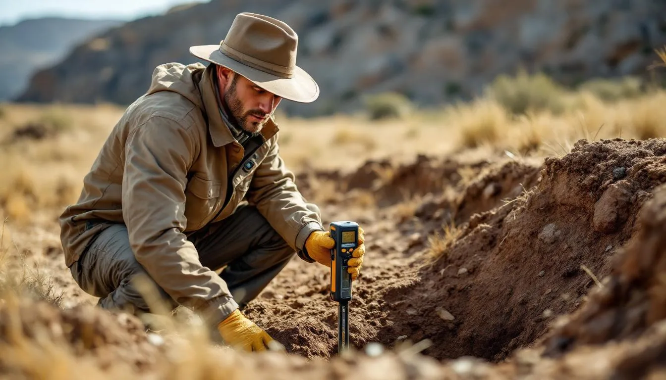
Hydrogeologists determine aquifer properties through pumping tests — pumping a well at a controlled rate while measuring water level changes in the pumped well and nearby observation wells. The rate and pattern of water level decline reveal:
- Transmissivity — how much water the aquifer can transmit (K × aquifer thickness)
- Storativity — how much water the aquifer releases from storage per unit decline in water level
- Boundary conditions — whether the aquifer connects to a river (a recharge boundary) or hits an impermeable wall (a barrier boundary)
These parameters are essential for predicting how the aquifer will respond to long-term pumping — will the water level stabilize? Will nearby streams dry up? Will neighboring wells go dry?
The Ogallala: A Case Study in Depletion
The Ogallala Aquifer (more properly, the High Plains Aquifer) underlies 174,000 square miles across eight US states, from South Dakota to Texas. It contains about 2.9 billion acre-feet of water — an almost incomprehensible volume that took millions of years to accumulate.
Large-scale irrigation pumping began in the 1950s and transformed the High Plains into one of the world’s most productive agricultural regions. About 30% of all US irrigation water comes from the Ogallala. It supports roughly $20 billion in annual crop production.
The problem: in much of the aquifer, pumping vastly exceeds natural recharge. Annual recharge in the southern High Plains (Texas, Kansas) averages about half an inch. Annual withdrawal rates can be 10 times that. Water levels have declined over 150 feet in parts of western Kansas and the Texas Panhandle. Some areas that once supported irrigated farming have returned to dryland agriculture as wells dried up.
The Ogallala isn’t being managed — it’s being mined. Current consumption is physically unsustainable. The question isn’t whether significant portions will be depleted, but when — and what happens to the communities and economies that depend on it.
Contamination: Groundwater’s Biggest Threat
Groundwater contamination is a slow-motion crisis. Because groundwater moves slowly, contamination plumes spread gradually and can persist for decades after the source is removed.
Common Contaminants
Nitrates from agricultural fertilizers and animal waste are the most widespread groundwater contaminant globally. Nitrate contamination above 10 mg/L (the US drinking water standard) causes methemoglobinemia (“blue baby syndrome”) in infants. About 20% of US shallow wells in agricultural areas exceed this standard.
Volatile organic compounds (VOCs) — industrial solvents like trichloroethylene (TCE) and perchloroethylene (PCE) — are particularly troublesome. They’re denser than water (called DNAPLs — dense non-aqueous phase liquids), so they sink to the bottom of aquifers and slowly dissolve, creating contamination plumes that can persist for centuries. The Superfund program, created in 1980, has spent billions cleaning up DNAPL-contaminated sites — with mixed success.
PFAS (per- and polyfluoroalkyl substances) — “forever chemicals” used in nonstick coatings, firefighting foam, and waterproof fabrics — are the newest contamination crisis. They don’t break down naturally, they’re mobile in groundwater, and they’re being detected in water supplies worldwide. The EPA set drinking water standards for several PFAS compounds in 2024 at extremely low levels (4 parts per trillion for PFOA and PFOS), reflecting their toxicity at minute concentrations.
Arsenic occurs naturally in certain geological formations and can dissolve into groundwater. Bangladesh’s arsenic crisis — where millions of tube wells drilled into arsenic-bearing sediments exposed over 50 million people to toxic arsenic levels — is one of the largest mass poisonings in history. Understanding the hydrogeochemistry (how geological materials interact chemically with groundwater) is essential for predicting where natural contamination will occur.
Remediation: The Painful Reality
Cleaning up contaminated groundwater is extraordinarily difficult and expensive. Common approaches:
Pump-and-treat — pumping contaminated groundwater to the surface and treating it. Simple in concept but often ineffective because contaminants trapped in soil pores and low-permeability zones slowly release back into the groundwater, requiring pumping for decades.
In situ remediation — treating contamination in place using injected chemicals, biological agents, or heat. Bioremediation (using bacteria to break down contaminants) works well for some petroleum hydrocarbons. Chemical oxidation (injecting oxidizing agents) can destroy certain organic contaminants. These methods avoid the cost of pumping but require detailed understanding of subsurface conditions.
Monitored natural attenuation — letting natural processes (dilution, biodegradation, chemical reactions) reduce contamination over time, while monitoring to ensure it works. This is the cheapest approach and sometimes genuinely effective — but it requires patience (decades) and certainty that the plume won’t reach water supply wells.
The total cost of groundwater contamination cleanup in the US alone is estimated at over $100 billion. Many contaminated sites will never be fully cleaned — the goal shifts from restoration to containment and risk management.
Climate Change and Groundwater
Climate change affects groundwater through multiple pathways:
Altered recharge — changing precipitation patterns mean more rain in some regions, less in others, and more intense events (which produce more runoff and less infiltration). Reduced snowpack in mountain regions decreases the slow spring melt that recharges many western US aquifers.
Increased demand — hotter, drier conditions increase irrigation demand, putting more pressure on already-stressed aquifers.
Sea level rise — in coastal areas, rising seas push saltwater into freshwater aquifers (saltwater intrusion). This is already affecting freshwater supplies in low-lying islands, coastal cities like Miami, and delta regions worldwide.
Ecosystem impacts — falling water tables disconnect streams from groundwater, reducing base flow (the groundwater component of stream flow that sustains rivers during dry periods). This affects aquatic ecosystems, water availability for downstream users, and the health of groundwater-dependent ecosystems like springs and wetlands.
The Future of Hydrogeology
Several developments are reshaping the field.
Managed aquifer recharge (MAR) — intentionally storing surface water underground during wet periods for later recovery during droughts. This can be done through spreading basins (flooding flat areas to increase infiltration), injection wells, or riverbank filtration. Orange County, California, operates one of the world’s largest MAR systems, recharging up to 100 million gallons per day of treated wastewater and recycled water into the local aquifer.
Remote sensing and satellite data — NASA’s GRACE (Gravity Recovery and Climate Experiment) satellites measure changes in Earth’s gravity field, revealing groundwater storage changes across entire basins. GRACE data showed that India’s northwestern aquifers lost 109 cubic kilometers of water between 2002 and 2008 — a depletion rate visible from space.
Computational modeling — increasingly sophisticated data analysis and numerical models simulate groundwater flow and contaminant transport in three dimensions over decades or centuries. These models guide pumping management, contamination remediation design, and water resource planning.
Water governance — perhaps the biggest challenge isn’t technical but institutional. In many jurisdictions, groundwater is poorly regulated. In most US states, landowners can pump as much groundwater as they want from beneath their property — even if it depletes their neighbors’ wells. Transitioning from unregulated to managed groundwater use requires political will that scientific knowledge alone doesn’t create.
Why You Should Pay Attention
Groundwater is the world’s largest accessible freshwater reserve. It’s being depleted in major agricultural regions worldwide. It’s being contaminated by industrial, agricultural, and naturally occurring chemicals. It’s being stressed by climate change.
These aren’t distant problems. About half of all Americans drink groundwater. If you live in the rural Midwest, your water almost certainly comes from a well. If you eat food grown with irrigated agriculture, you’re indirectly dependent on groundwater even if your personal water supply comes from a reservoir.
Hydrogeology exists because this invisible resource — one we cannot live without — requires scientific understanding to protect and manage. The water beneath your feet is both ancient and fragile. Understanding how it got there, how it moves, and what threatens it is not an academic exercise. It’s a survival skill for the 21st century.
Frequently Asked Questions
How much of Earth's freshwater is groundwater?
About 30% of Earth's freshwater is groundwater — roughly 10.6 million cubic kilometers. That's about 100 times more freshwater than exists in all the world's rivers and lakes combined. Ice caps and glaciers hold about 69% of freshwater, making groundwater the largest accessible freshwater reserve on the planet.
What is an aquifer?
An aquifer is a body of rock or sediment that holds and transmits usable quantities of groundwater. Good aquifers are made of permeable materials — sandstone, gravel, fractured limestone — that have interconnected pore spaces allowing water to flow. The Ogallala Aquifer in the central United States is one of the world's largest, underlying 174,000 square miles across eight states and supplying about 30% of US irrigation water.
Can groundwater run out?
Yes. When pumping exceeds natural recharge over long periods, aquifer levels decline — sometimes permanently. The Ogallala Aquifer has lost an estimated 410 cubic kilometers of water since large-scale pumping began in the 1950s. Some aquifers in arid regions contain 'fossil water' deposited thousands of years ago that receives essentially no modern recharge. Once depleted, these aquifers are gone for practical purposes.
How does groundwater become contaminated?
Common contamination sources include agricultural chemicals (nitrates, pesticides), industrial solvents, leaking underground storage tanks, septic systems, landfill leachate, mining waste, and road salt. Once contaminated, groundwater is extremely difficult and expensive to clean because water moves slowly underground and contaminants can persist for decades or centuries.
Further Reading
Cite this article
APA
WhatIs.site. (2026). What Is Hydrogeology?. Retrieved May 27, 2026, from https://whatis.site/hydrogeology MLA
"What Is Hydrogeology?." WhatIs.site, March 6, 2026, https://whatis.site/hydrogeology. Accessed May 27, 2026. Chicago
WhatIs.site. "What Is Hydrogeology?." Last modified May 12, 2026. https://whatis.site/hydrogeology. HTML
<a href="https://whatis.site/hydrogeology">What Is Hydrogeology?</a> — WhatIs.site Related Articles
What Is Civil Engineering?
Civil engineering designs and builds infrastructure like roads, bridges, and buildings. Learn about its branches, history, and how it shapes daily life.
scienceWhat Is Chemistry?
Chemistry is the science of matter and how substances interact, bond, and transform. Learn about atoms, molecules, reactions, and why chemistry matters.
scienceWhat Is Climatology?
Climatology is the scientific study of climate patterns, causes, and changes over time. Learn how it differs from meteorology and why it matters today.
scienceWhat Is Conservation Biology?
Conservation biology is the scientific discipline dedicated to understanding and protecting Earth's biological diversity — the variety of species, genes.
technologyWhat Is Chemical Engineering?
Chemical engineering applies chemistry, physics, math, and biology to design processes that transform raw materials into useful products at industrial scale.