Table of Contents
What Is Geomorphology?
Geomorphology is the scientific study of landforms and the processes that shape Earth’s surface. It examines how mountains rise, how rivers carve valleys, how coastlines erode, and how glaciers sculpt terrain—essentially asking why the field looks the way it does and how it will change over time.
The Science of Field
Look out any window. Whatever you see—hills, flat plains, river valleys, coastal cliffs—has a story. Geomorphology is the science of reading that story. Every slope, every ridge, every bend in a river exists because specific physical, chemical, and biological processes acted on specific materials over specific timescales.
The field sits at the intersection of geology, physics, chemistry, and biology. A geomorphologist might study the physics of flowing water to understand river channel formation, the chemistry of mineral dissolution to explain cave development, or the biology of vegetation to predict hillslope stability.
What makes geomorphology distinct from general geology is its focus on surface processes and forms. Geologists study Earth from core to crust. Geomorphologists concentrate on what happens at and near the surface—the interface between rock, water, air, and life.
A Brief History
The roots of geomorphology stretch back to the 18th century. James Hutton, often called the father of modern geology, proposed in 1788 that Earth’s surface is shaped by ongoing natural processes—not biblical floods. This was radical. The idea that landscapes evolve slowly through ordinary erosion and deposition challenged centuries of religious interpretation.
In the late 1800s, American geographer William Morris Davis developed the “cycle of erosion” theory, proposing that landscapes pass through stages of youth (steep, rugged terrain), maturity (gentler slopes), and old age (flat peneplains). His framework dominated geomorphology for decades—and while it turned out to be overly simplistic, it established geomorphology as a distinct scientific discipline.
The 20th century brought a shift toward quantitative, process-based geomorphology. Instead of classifying landscapes into stages, researchers began measuring the actual forces—water velocity, sediment transport rates, tectonic uplift—that create landforms. This approach, combining field measurements with physics and mathematics, defines modern geomorphology.
The Forces That Shape the Land
Earth’s surface is caught in a constant tug-of-war between forces that build terrain up and forces that tear it down. Understanding this interplay is the core of geomorphology.
Tectonic Forces: Building Up
Plate tectonics provides the raw material for landforms. When plates collide, mountains rise. The Himalayas are still growing—India continues pushing into Asia at about 5 centimeters per year, and the mountains gain roughly 5 millimeters of height annually. That doesn’t sound like much until you multiply by millions of years.
Volcanic activity creates landforms rapidly. Mount St. Helens lost 400 meters of elevation in a single eruption in 1980. Hawaii’s Big Island grows as lava flows extend its coastline. Iceland sits on a mid-ocean ridge where new crust is literally being manufactured.
Earthquakes reshape landscapes through faulting—vertical and horizontal displacement along fractures in the crust. The San Andreas Fault moves Los Angeles northwest relative to San Francisco by about 46 millimeters per year. In 15 million years, LA will be a suburb of San Francisco. (The real estate implications are unclear.)
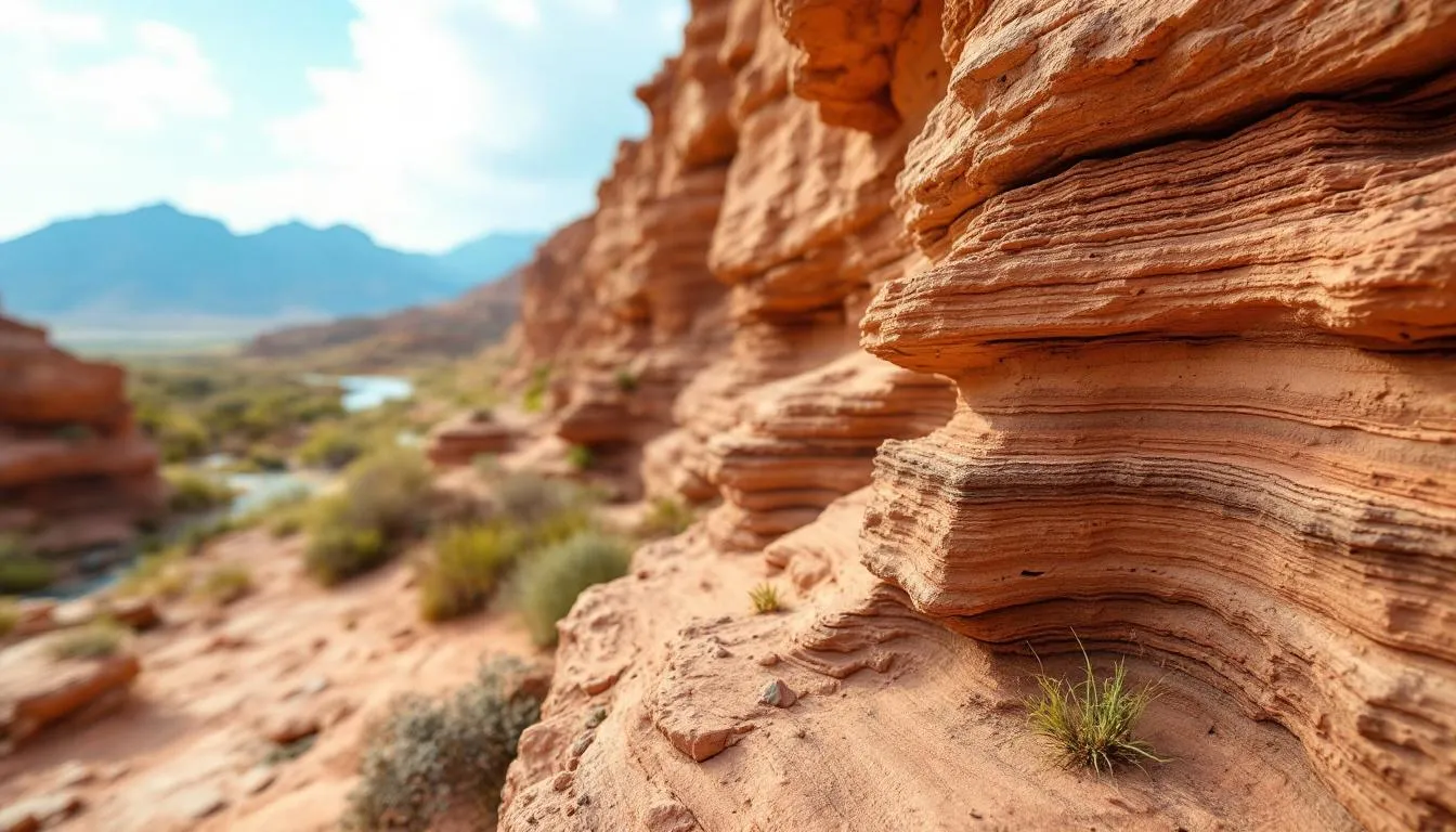
Weathering: Breaking Down
Weathering breaks rock into smaller pieces without moving them. It comes in three flavors:
Physical (mechanical) weathering breaks rock through physical forces. Freeze-thaw cycles are devastatingly effective—water seeps into cracks, freezes, expands by 9%, and wedges the rock apart. In cold climates, this process shatters even the hardest granite. Thermal expansion and contraction, salt crystal growth, and plant root growth also break rock mechanically.
Chemical weathering dissolves or chemically alters minerals. Rainwater is slightly acidic (it absorbs CO2 from the atmosphere), and over time this weak acid dissolves limestone, creating caves, sinkholes, and karst landscapes. Iron-bearing minerals rust (oxidize). Feldspar—one of the most common minerals in Earth’s crust—breaks down into clay through a process called hydrolysis.
Biological weathering is caused by living organisms. Tree roots pry rock apart. Lichens secrete acids that dissolve mineral surfaces. Burrowing animals mix and loosen soil. It’s slower than the other types but surprisingly effective over geological timescales.
Erosion: Moving Material
Erosion is weathering plus transport. Once rock breaks down, something has to move the pieces. The main agents of erosion are water, wind, ice, and gravity.
Water is the dominant erosional force on most of Earth’s surface. Rivers carry enormous quantities of sediment—the Mississippi River alone delivers about 200 million tons of sediment to the Gulf of Mexico each year. Rainfall erodes hillslopes through splash erosion (individual raindrops dislodging particles) and sheet wash (thin films of water carrying particles downhill).
Wind erosion matters most in arid and semi-arid environments. It creates sand dunes, erodes rock into bizarre formations (ventifacts and yardangs), and transports fine dust across continents. Saharan dust regularly crosses the Atlantic to fertilize the Amazon rainforest—a connection between African geomorphology and South American ecology.
Glaciers are extraordinarily powerful erosional agents. A glacier doesn’t just scrape rock—it plucks boulders from bedrock, grinds them against the valley floor, and reshapes entire mountain ranges. U-shaped valleys, cirques, fjords, and moraines are all glacial landforms. During ice ages, glaciers covered about 30% of Earth’s land surface and fundamentally reshaped the landscapes of North America, Europe, and parts of South America.
Gravity drives mass movements: landslides, rockfalls, mudflows, and creep (the slow, imperceptible downhill movement of soil). These processes transfer material from higher to lower elevations and can reshape terrain catastrophically fast. The 1970 Huascaran landslide in Peru traveled 18 kilometers in about 4 minutes, burying entire towns.
Major Landform Types
Geomorphologists classify landforms by the processes that create them.
Fluvial Landforms (Rivers)
Rivers are Earth’s primary sculptors. They create V-shaped valleys, floodplains, meanders, oxbow lakes, deltas, alluvial fans, and terraces. The shape of a river channel reflects a balance between the water’s erosive energy and the resistance of its bed and banks.
Rivers evolve over time. Young rivers in mountainous terrain tend to be steep and fast, cutting downward aggressively. Mature rivers on gentler slopes meander across broad floodplains, depositing sediment in characteristic patterns. But this isn’t a rigid sequence—tectonic uplift can rejuvenate an old river, and a dam (natural or artificial) can completely reorganize a river’s behavior.
Understanding fluvial geomorphology matters enormously for practical purposes. Flood prediction, water management, bridge design, and urban planning all require knowledge of how rivers behave and how their channels change over time.
Glacial Landforms
Glaciers leave distinctive signatures on the field. Cirques (armchair-shaped hollows), aretes (knife-edge ridges), horns (like the Matterhorn), U-shaped valleys, hanging valleys, and moraines (ridges of debris deposited at glacier margins) are all diagnostic of past glaciation.
About 10% of Earth’s land surface is currently covered by glaciers. During the last ice age (peaking about 20,000 years ago), that figure was about 30%. The landscapes of Canada, northern Europe, Patagonia, and New Zealand were profoundly shaped by glacial processes that operated for tens of thousands of years.
Today, glacial geomorphology takes on new urgency as climate change causes glaciers to retreat worldwide. This affects water supplies for billions of people—many major rivers, including the Ganges, Yangtze, and Indus, depend on glacial meltwater.
Coastal Landforms
Coastlines are among the most active landscapes on Earth. Waves, tides, currents, and sea-level changes constantly reshape them. Coastal landforms include cliffs, beaches, spits, barrier islands, sea stacks, wave-cut platforms, and estuaries.
Coastal geomorphology matters because about 40% of the world’s population lives within 100 kilometers of a coast. Understanding beach erosion, cliff retreat, and barrier island migration is essential for protecting communities. Sea-level rise from climate change—projected at 0.3 to 1.0 meters by 2100—adds urgency to coastal geomorphological research.
Aeolian Landforms (Wind)
In deserts and semi-arid regions, wind creates sand dunes (in at least six distinct forms), desert pavements (flat surfaces armored with pebbles), and erosional features like yardangs (streamlined rock ridges) and ventifacts (wind-polished stones).
Sand dunes are surprisingly complex. Their shape depends on wind direction, sand supply, and vegetation. Barchan dunes form in areas with limited sand and unidirectional wind. Star dunes form where winds blow from multiple directions. Linear dunes can stretch for hundreds of kilometers.
Karst Landforms
When slightly acidic water dissolves soluble bedrock—usually limestone—it creates karst landscapes. Caves, sinkholes, disappearing streams, and tower karst (the dramatic limestone pinnacles of southern China and Vietnam) are all karst features.
About 20% of Earth’s ice-free land surface is karst terrain. Karst aquifers provide drinking water for roughly 25% of the world’s population. Understanding karst geomorphology is critical for groundwater management because karst aquifers behave very differently from other types—water flows through large channels rather than pores, making them both highly productive and highly vulnerable to contamination.
Volcanic Landforms
Volcanoes create some of the most dramatic landforms on Earth. Shield volcanoes (like Hawaii’s Mauna Loa) build broad, gently-sloped structures from fluid lava flows. Stratovolcanoes (like Mount Fuji) create steep, symmetrical cones from alternating lava and ash layers. Calderas form when a volcano’s magma chamber empties and the surface collapses—Yellowstone sits in a caldera 72 kilometers long.
Volcanic activity also creates lava plateaus, volcanic islands, hot springs, and geysers. It’s one of the few geomorphological processes that genuinely creates new land from scratch.
Measuring and Modeling Landscapes
Modern geomorphology relies heavily on technology for measurement and modeling.
Remote Sensing
Satellites and aircraft provide geomorphologists with data at scales impossible to collect from the ground. LiDAR (Light Detection and Ranging) can map terrain beneath forest canopy with centimeter-level accuracy. Satellite radar interferometry detects ground movement of just millimeters—enough to monitor landslide creep, volcanic inflation, and tectonic strain.
Cartography and geographic information systems (GIS) allow geomorphologists to analyze spatial patterns in field data, overlay geological and topographic information, and model field evolution.
Field Measurement
Despite technological advances, fieldwork remains essential. Geomorphologists measure stream discharge, sediment transport rates, erosion rates, soil properties, and rock strength directly. They install monitoring equipment—stream gauges, rain gauges, GPS stations, erosion pins—to track field change over time.
Some measurements require patience. Cosmogenic nuclide dating measures how long rock surfaces have been exposed to cosmic radiation, revealing erosion rates averaged over thousands to millions of years. It’s like asking the rock itself how quickly it’s wearing away.
Numerical Modeling
Computer models simulate field evolution over timescales impossible to observe directly. These models combine equations describing erosion, sediment transport, tectonic uplift, and climate forcing to predict how landscapes change over thousands to millions of years.
Field evolution models have revealed surprising insights—for example, that mountain ranges can reach a steady-state height where uplift and erosion balance, or that river networks organize themselves into fractal patterns that maximize transport efficiency.
Applied Geomorphology
Geomorphology isn’t just academic. It has direct practical applications.
Natural Hazard Assessment
Landslides, floods, coastal erosion, volcanic eruptions—these are all geomorphological hazards. Geomorphologists identify areas prone to these events, estimate their frequency and magnitude, and help design mitigation strategies.
After a major landslide, geomorphologists map the affected area, analyze why it failed, and assess whether similar slopes nearby might fail next. Before a dam is built, geomorphologists evaluate whether the site is geologically suitable and how the reservoir will affect upstream and downstream sediment dynamics.
Environmental Management
River restoration projects require geomorphological expertise. When a channelized river is returned to a more natural state, geomorphologists design the new channel geometry to ensure it’s stable—the right width, depth, slope, and sinuosity for the water and sediment it carries.
Agricultural land management benefits from understanding erosion processes. Geomorphologists help design terracing, buffer strips, and drainage systems that minimize soil loss while maintaining productivity. Globally, about 24 billion tons of topsoil are lost to erosion annually—a problem with direct implications for food security.
Engineering and Construction
Roads, bridges, tunnels, and buildings all interact with the field. Geomorphological assessment identifies potential problems—unstable slopes, subsidence-prone ground, flood-vulnerable locations—before construction begins, when solutions are cheapest.
In coastal areas, geomorphological understanding guides decisions about sea walls, beach nourishment, and managed retreat. Hard engineering (sea walls, groins) often simply shifts erosion problems elsewhere. Modern coastal management increasingly uses geomorphological principles to work with natural processes rather than against them.
Planetary Geomorphology
Geomorphology isn’t limited to Earth. Mars has river channels (evidence of past water), massive volcanoes (Olympus Mons is 2.5 times the height of Everest), and spectacular canyons (Valles Marineris stretches 4,000 kilometers). Titan, Saturn’s largest moon, has methane rivers and lakes. Pluto has nitrogen glaciers.
Applying geomorphological reasoning to other planets helps scientists reconstruct their environmental histories. The presence of fluvial landforms on Mars tells us that liquid water once flowed on its surface—one of the most significant findings in planetary science.
The Human Factor
Here’s something that might surprise you: humans are now the dominant geomorphological force on the planet. We move more earth annually through mining, construction, and agriculture than all natural rivers combined. We’ve dammed or diverted most major rivers. We’ve reshaped coastlines with seawalls and harbors. We’ve leveled mountains and filled valleys.
This isn’t new. Ancient civilizations modified landscapes extensively—terracing hillsides, draining marshes, deforesting vast areas. But the scale has increased enormously. Modern mining operations move billions of tons of rock annually. Urbanization converts natural landscapes to impervious surfaces at rates unprecedented in Earth’s history.
Some geomorphologists argue that we’ve entered the “Anthropocene”—a new geological epoch defined by human modification of Earth’s surface and atmosphere. Whether or not this term is officially adopted, the reality is clear: understanding human impacts on field is now a central concern of geomorphology.
Climate and Geomorphology
Climate and field are intimately connected. Climate controls which geomorphological processes dominate: glacial erosion in cold regions, chemical weathering in the humid tropics, wind erosion in deserts. But the relationship goes both ways—landscapes also influence climate.
Mountain ranges force air upward, causing precipitation on one side and aridity on the other (the rain shadow effect). The uplift of the Tibetan Plateau over the past 50 million years fundamentally reorganized Asian monsoon patterns.
As climate patterns shift, geomorphological processes change too. Permafrost thaw in the Arctic is destabilizing vast areas of field, causing ground subsidence, coastal erosion, and landslides. Changing precipitation patterns alter river discharge and sediment transport. Glacier retreat exposes new rock surfaces to weathering.
Understanding these climate-field feedbacks is one of the most pressing challenges in modern geomorphology.
The Future of the Field
Geomorphology is evolving rapidly. New technologies—drones, high-resolution satellite imagery, LiDAR, cosmogenic dating, numerical modeling—provide unprecedented ability to measure and simulate field processes. The integration of data science and machine learning is beginning to reveal patterns in field data that traditional methods missed.
The field is also becoming more interdisciplinary. Biogeomorphology studies how organisms shape landscapes (and vice versa). Tectonic geomorphology uses field features to infer tectonic processes occurring deep in the crust. Critical zone science integrates geomorphology with hydrology, soil science, ecology, and geochemistry to understand Earth’s life-supporting surface layer.
Key Takeaways
Geomorphology is the study of Earth’s landforms and the processes that shape them. It explains why mountains exist, why rivers meander, why coastlines change, and why landscapes look the way they do. The field combines physics, chemistry, biology, and geology to understand surface processes operating across timescales from seconds to billions of years.
It has direct practical applications in natural hazard assessment, environmental management, engineering, and climate adaptation. And as human impacts on Earth’s surface intensify, geomorphological understanding becomes increasingly essential for making informed decisions about how we interact with the field we all depend on.
Every hill, valley, and beach has a story. Geomorphology is the science of reading it.
Frequently Asked Questions
What is the difference between geomorphology and geology?
Geology is the broad study of Earth's materials, structure, and history. Geomorphology is a subfield that specifically focuses on landforms—mountains, valleys, rivers, coastlines—and the processes that create and modify them. A geologist might study rock composition; a geomorphologist asks why a mountain is that particular shape.
How long does it take for geomorphological processes to shape a landscape?
It varies enormously. A landslide reshapes terrain in seconds. A river carves a canyon over millions of years. Glaciers sculpt valleys over tens of thousands of years. Volcanic eruptions create new landforms almost instantly. Geomorphology operates across every timescale from seconds to billions of years.
Why does geomorphology matter for everyday life?
Geomorphology directly informs flood prediction, landslide hazard assessment, coastal erosion management, dam and bridge site selection, and urban planning. Understanding how landscapes change helps communities build in safe locations and prepare for natural hazards.
Can humans cause geomorphological change?
Absolutely. Mining, deforestation, dam construction, urbanization, and agriculture all reshape landscapes significantly. Humans now move more sediment annually than all natural rivers combined. Some geomorphologists argue we are currently the dominant geomorphological force on the planet.
Further Reading
Cite this article
APA
WhatIs.site. (2026). What Is Geomorphology?. Retrieved May 27, 2026, from https://whatis.site/geomorphology MLA
"What Is Geomorphology?." WhatIs.site, March 6, 2026, https://whatis.site/geomorphology. Accessed May 27, 2026. Chicago
WhatIs.site. "What Is Geomorphology?." Last modified May 12, 2026. https://whatis.site/geomorphology. HTML
<a href="https://whatis.site/geomorphology">What Is Geomorphology?</a> — WhatIs.site Related Articles
What Is Climatology?
Climatology is the scientific study of climate patterns, causes, and changes over time. Learn how it differs from meteorology and why it matters today.
scienceWhat Is Cartography?
Cartography is the science, art, and technology of creating maps — visual representations of spatial relationships that communicate geographic information.
scienceWhat Is Agriculture?
Agriculture is the practice of cultivating plants, raising animals, and processing natural resources to produce food, fiber, and fuel.
scienceWhat Is Conservation Biology?
Conservation biology is the scientific discipline dedicated to understanding and protecting Earth's biological diversity — the variety of species, genes.
scienceWhat Is Archaeology?
Archaeology is the study of human history through physical remains like artifacts, buildings, and bones. Learn about methods, famous discoveries, and careers.